Most visitors would never guess this sleepy little island on the coast of Georgia gave birth to the most powerful financial system in modern history. Or that the genesis transpired in total secrecy. But that’s what happened, right here. How that came about in this remote place is an interesting tale, with an interesting backstory.
All vowels, no consonants. Add extra syllables, but wander off before you get to the end of words, like you lost your train of thought, or just couldn’t be bothered. Sound the way a jellyfish swims – a drifting pulsing rhythm, a heartbeat without hurry, journey with no destination. Speak as from your deathbed, expiring in the ubiquitous oppressive heat and humidity, as we surely are, and you’ve got pretty close.
There are no awards for diction. Honors go to the most elaborate expressions for the simplest things, so surplus phonemes are thrown in for good measure. Here the shade tree mechanic patching your leaky tire (in a wrecked rural town well off the interstate, cicadas throbbing the air like a migraine) will point at the tiny hole he found and not call it tiny. He will instead proudly gesticulate to it with the nub of a missing finger, tip back his ballcap, and share with you his sincere wonder that miracles still astound us every day, if you but have eyes to see. Like a king tapping with his ceremonial sword the shoulder of a new knight, he will pronounce the hole “minuscule.” And still, he will draw out those three syllables closer to five.
This is how you speak Southern.
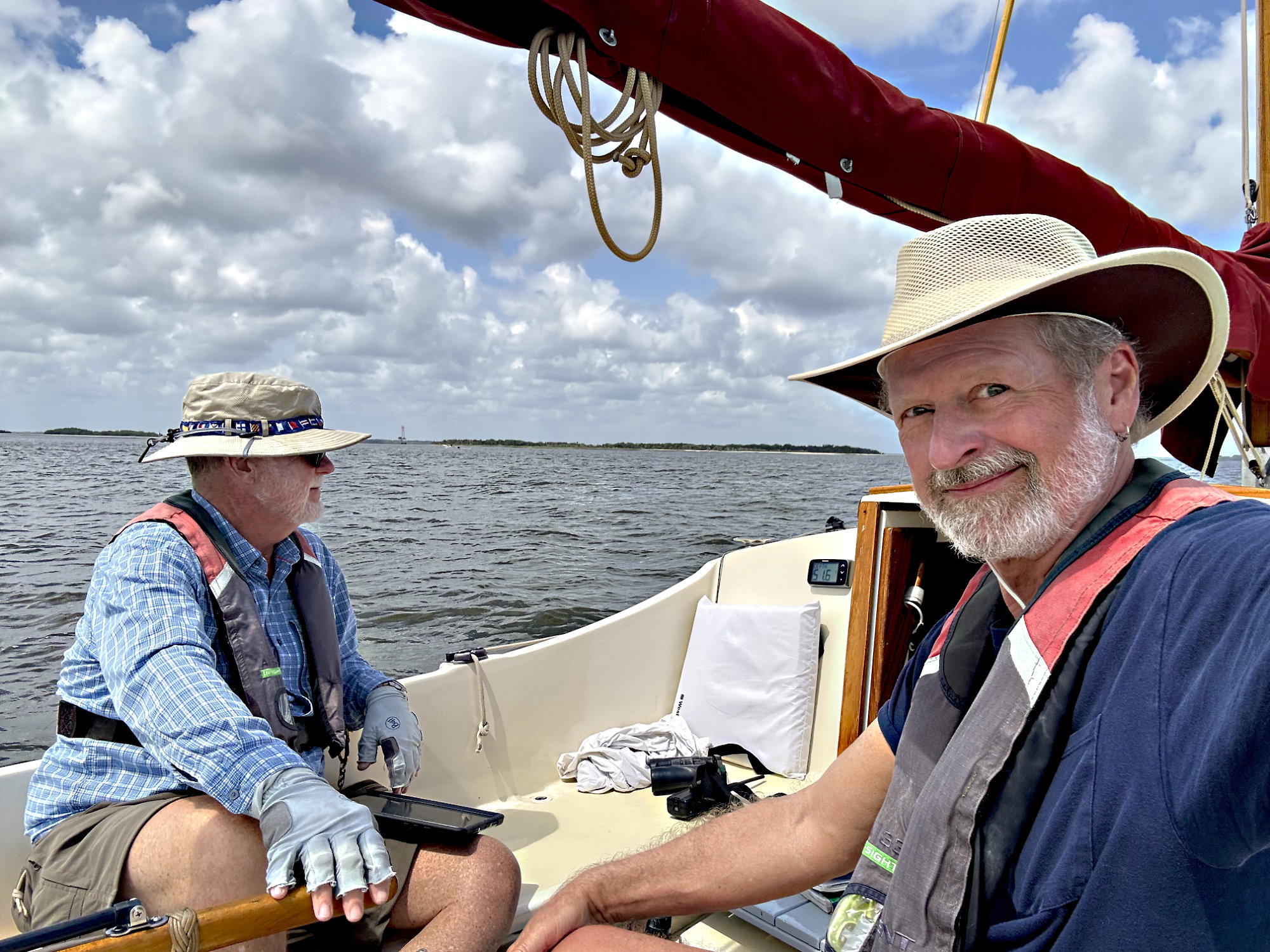
Doug grew up in NJ and was educated in the King’s English – trained, tested, and ranked. He made a living by speaking and writing very clearly to explain medical and bureaucratic arcana to those not inducted into their mysteries. And he was good at it. So it came as quite a surprise that he needed a native Southerner like me to be his interpreter in the Lowcountry. “We ARE still in the US, right?”
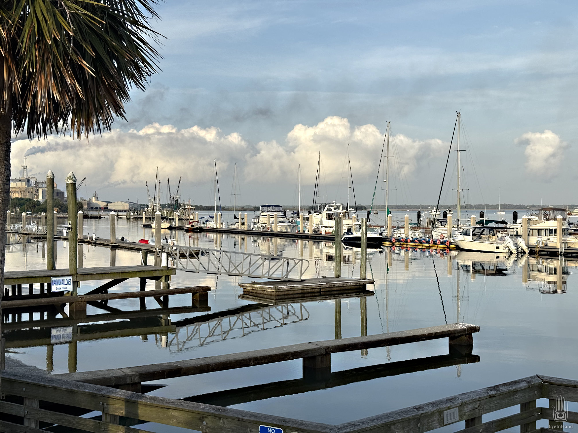
So much drama for such a tranquil place. Past AND present.
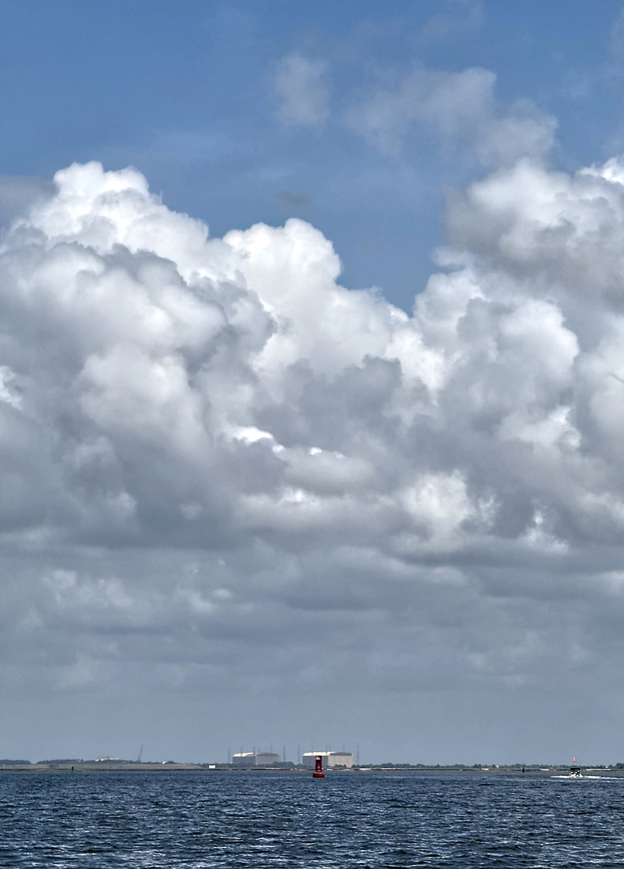
Kings Bay Drydocks on the horizon
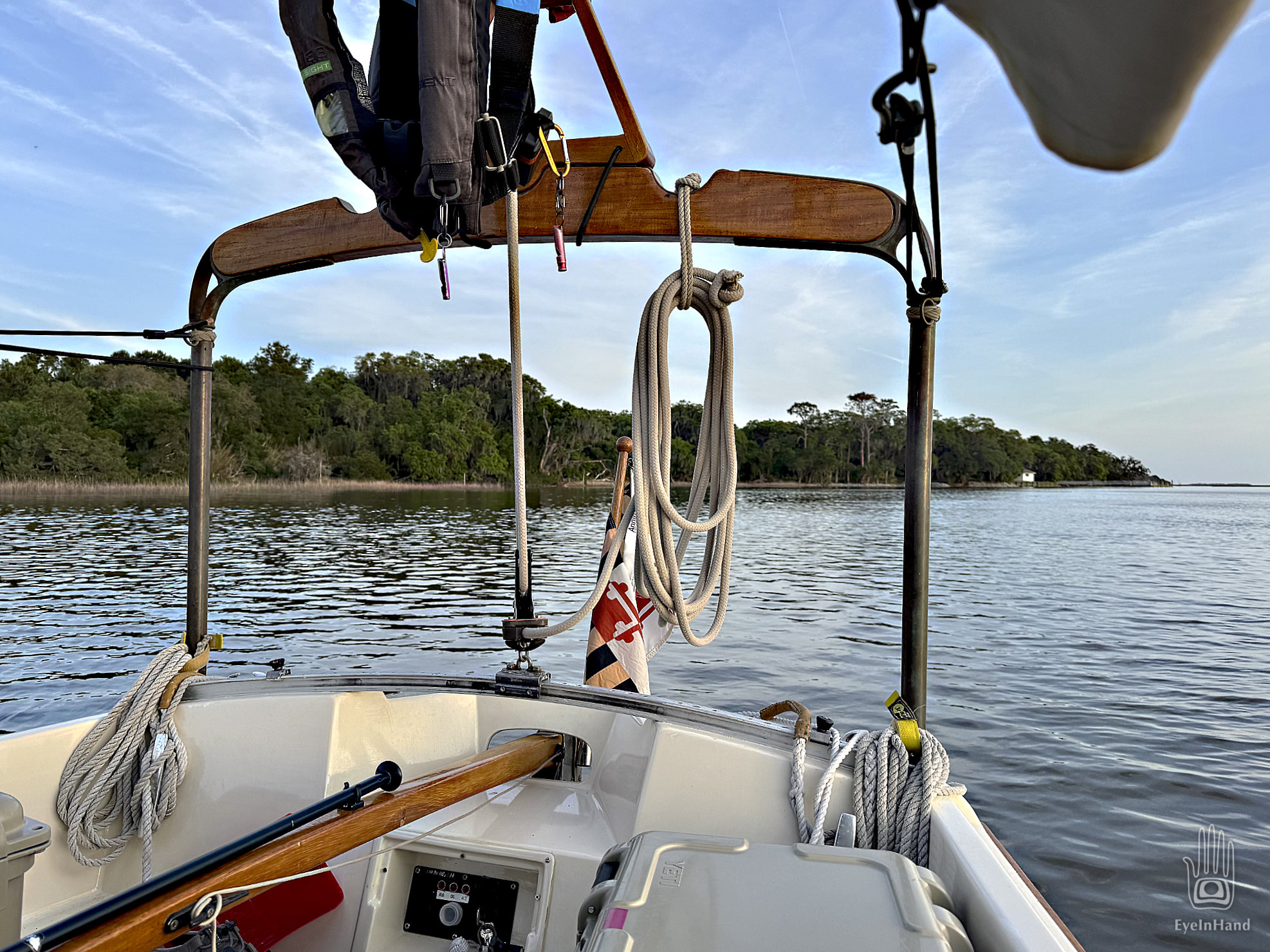
It’s about 4 in the afternoon when we drop anchor in Brickhill River, “river” though not much wider than a creek here. The tide is low and slack, just starting to turn. Toward the west is a broad marsh, so wide and flat we can see the dry-docks of Kings Bay on the horizon to the south. A forested mainland sweeps all the way north in a thin blue line.
Distant mainland
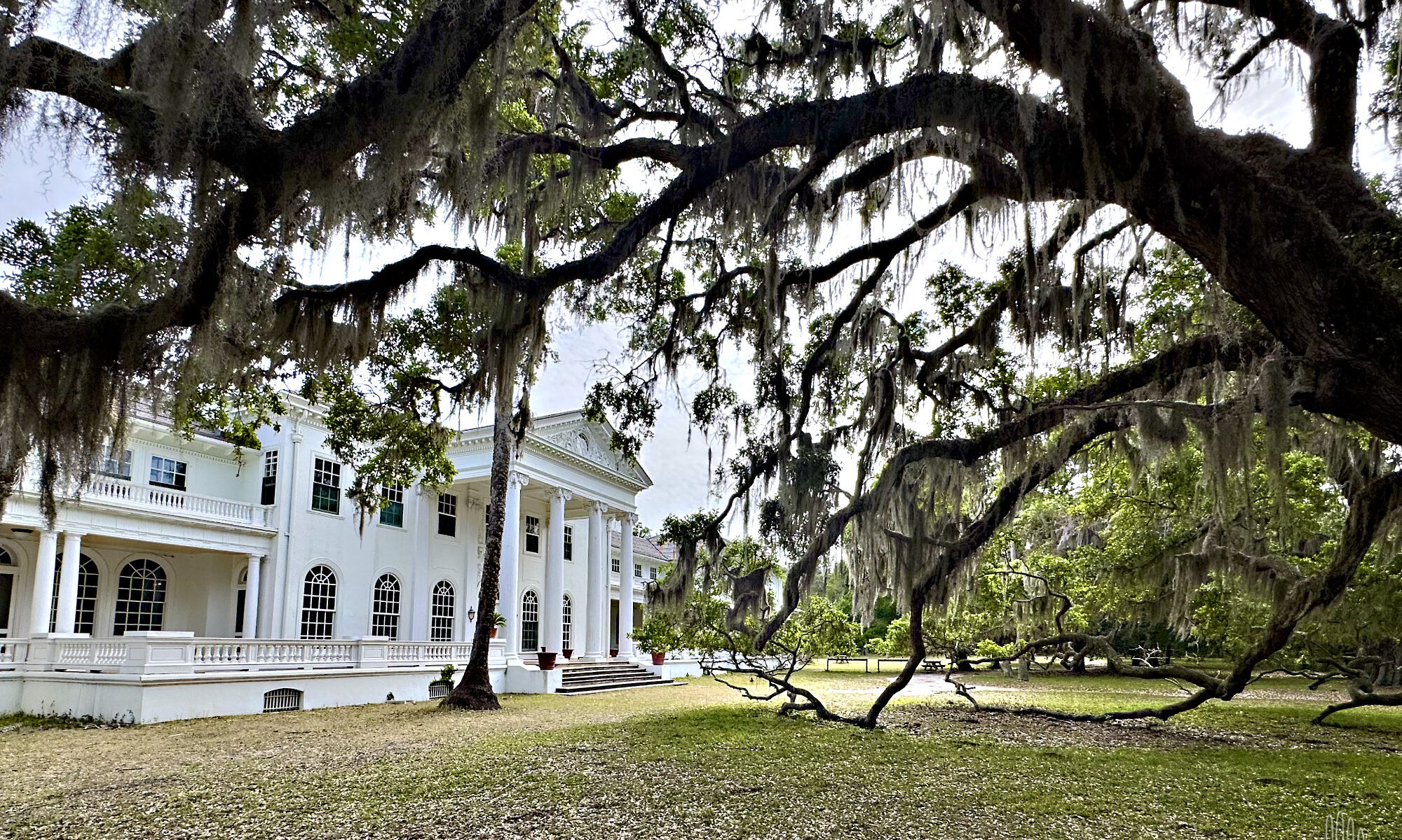
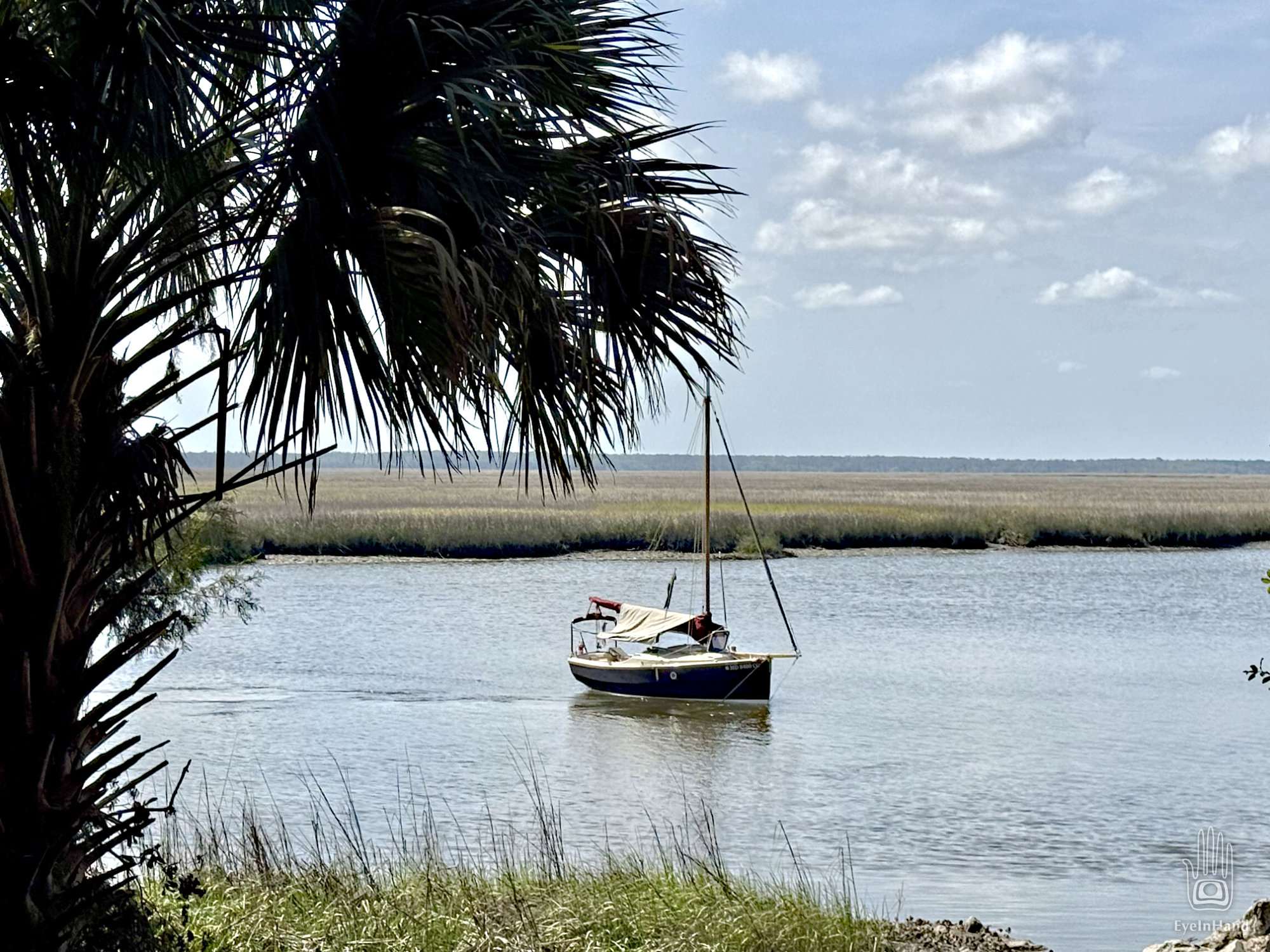
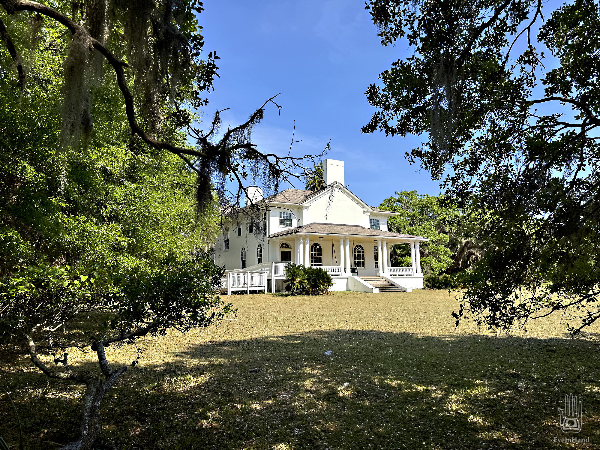
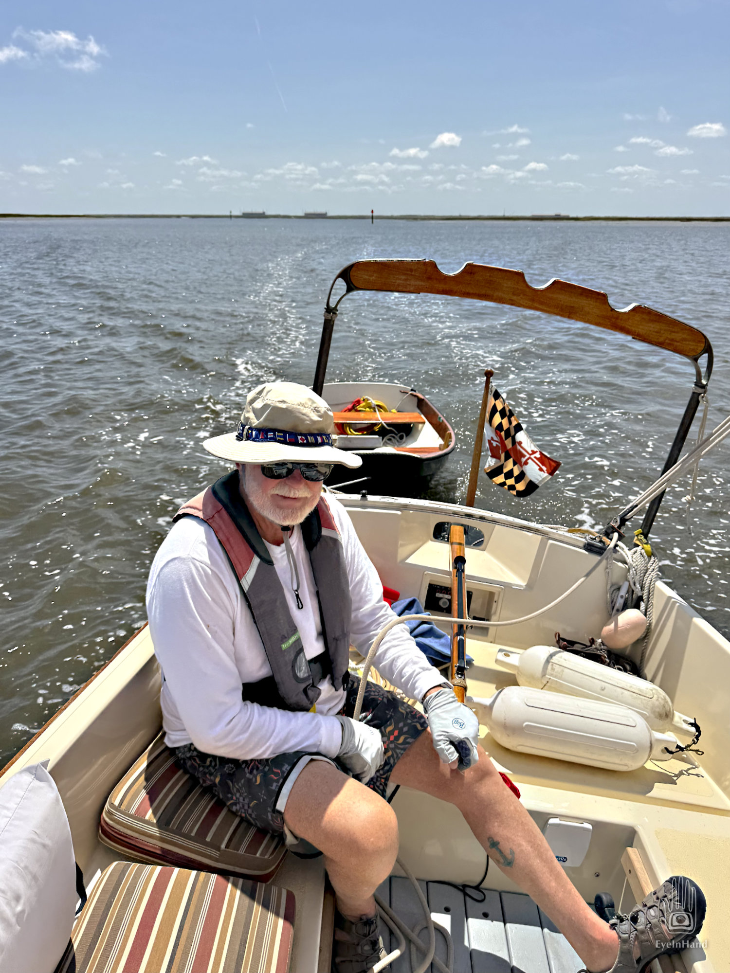
We row ashore and climb the sandy bluff to a sand road. It curls along the bluff under live oaks, circles a grassy lawn big as two football fields. Through the trees are the white columns of the Carnegie mansion known as Plum Orchard. We get views of Tidings as we walk the road. Doug pauses and cocks his head.
“Something doesn’t look right. See how she’s swinging back and forth?”
Tidings a little cockeyed when we leave her
Though the current is still weak, she seems broadside to it, and gently swings to and fro like a pendulum.
“Hmm. Odd. Maybe just the wind. She’s probably fine, right?” I can see Doug pondering while we stroll around to the back of the house.
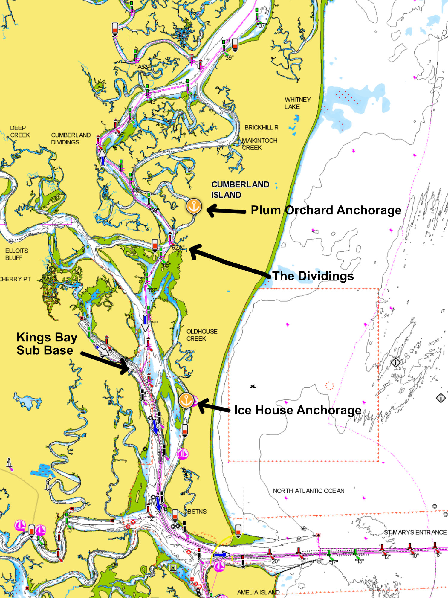
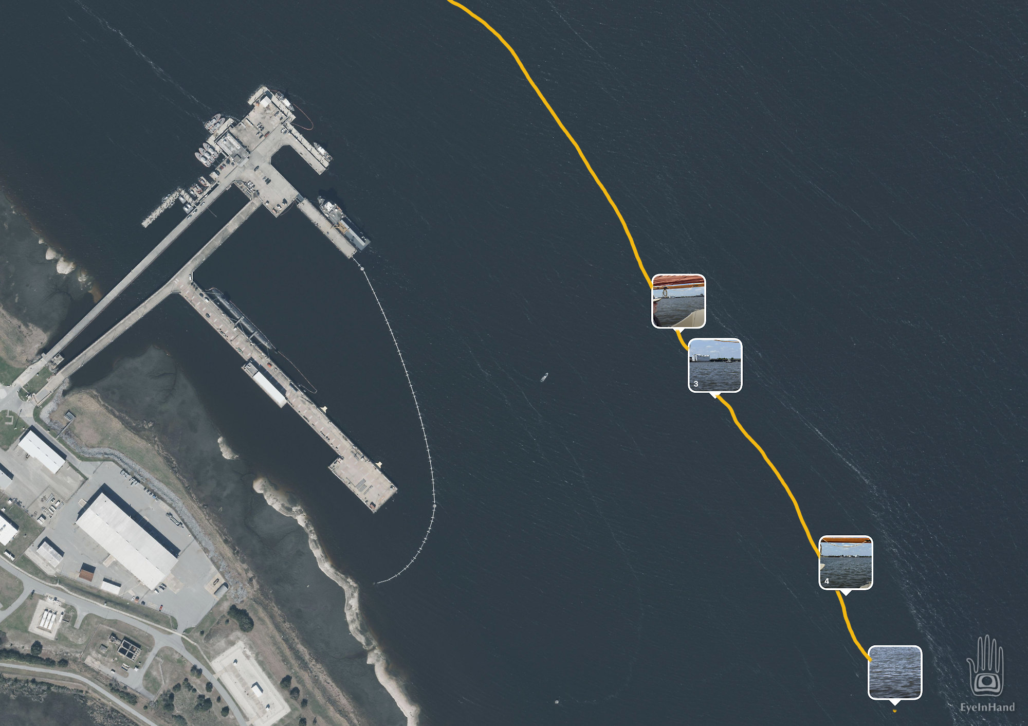
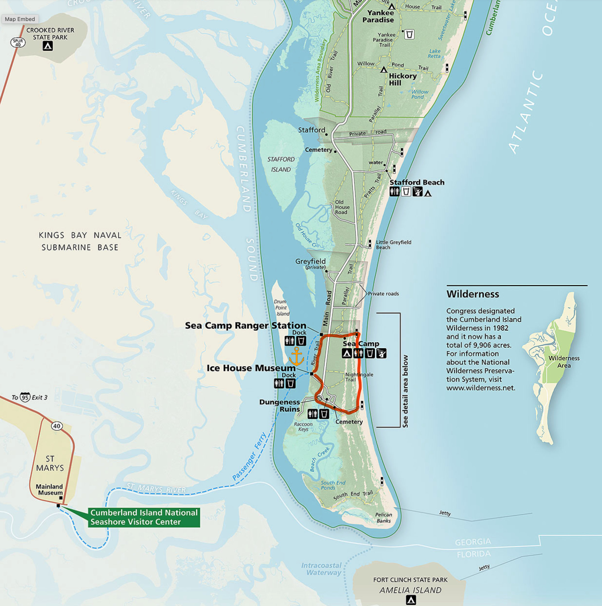
Though Cumberland is the largest of the sea islands at 20 miles long, we only need to go half that far to the anchorage at Plum Orchard. If we continue up the East River, we could bypass Kings Bay Submarine Base to reconnect with Cumberland Sound. But charts show shoals that way. With the tide falling we don’t want to risk it. The more prudent route is back south and around to the west to follow the ICW, which runs right past the base.
ICW passes near Kings Bay
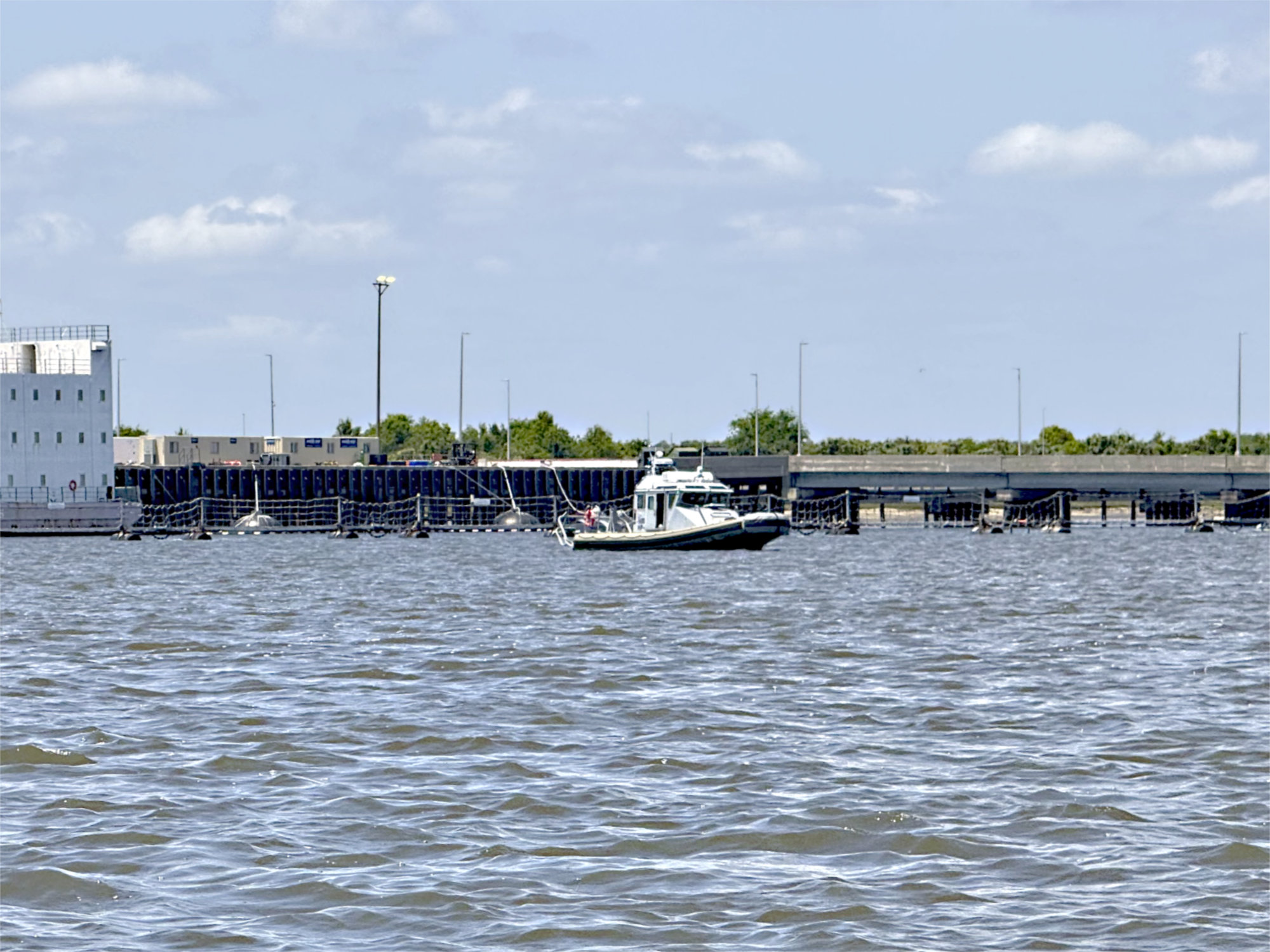
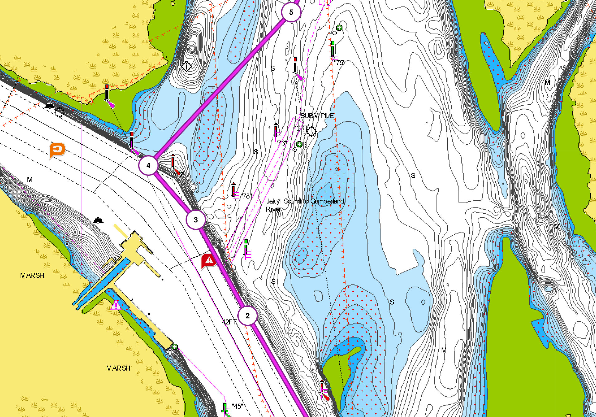
We prefer to give these twitchy military folks a wide berth, so skirt the edge of the channel as far outside as we dare. Last thing we want to do is run aground right here, of all places, and make a nuisance of ourselves. A disconcerting problem is the ICW presently passes through the middle of the “special security zone”. It appears the Army Corps of Engineers dredges frequently for subs to navigate easily; but the ICW is allowed to follow a natural shifting course. Instead of dredging a route to move civilian traffic away from the base, they just move the channel markers.
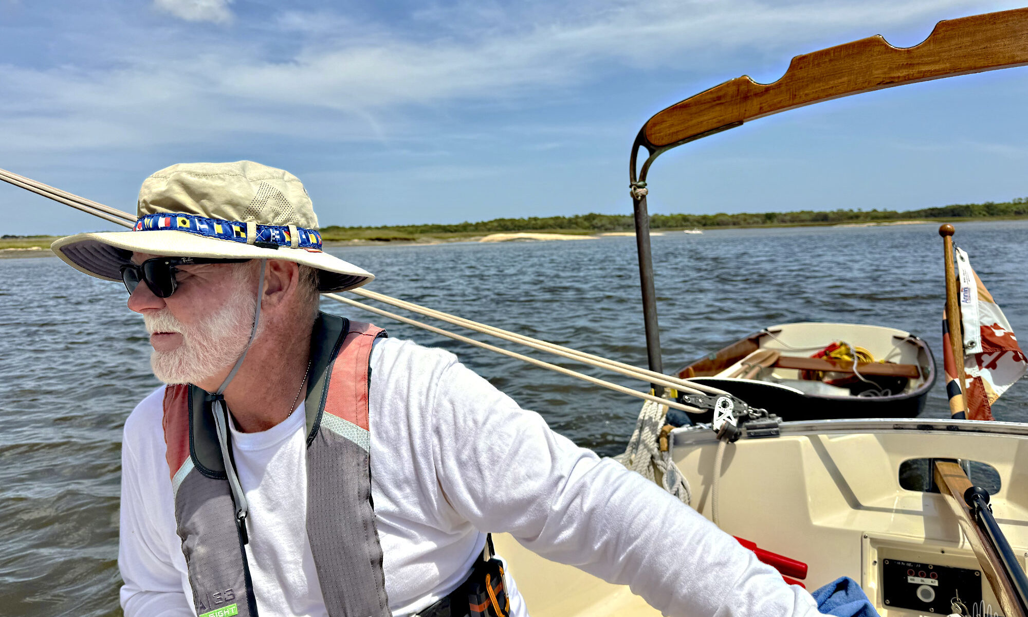
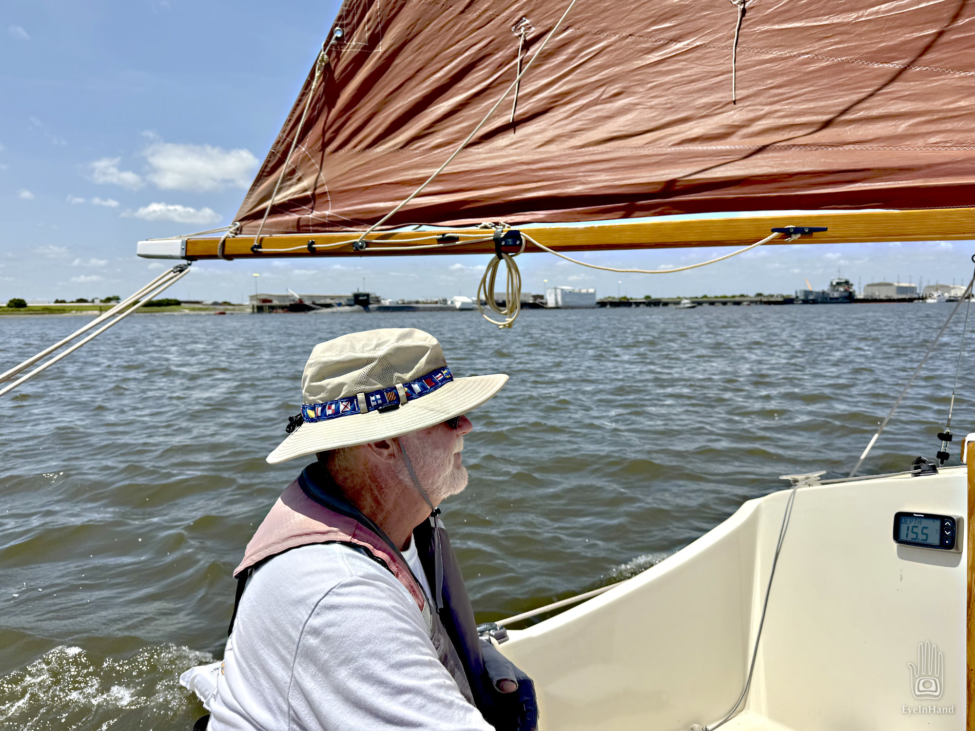
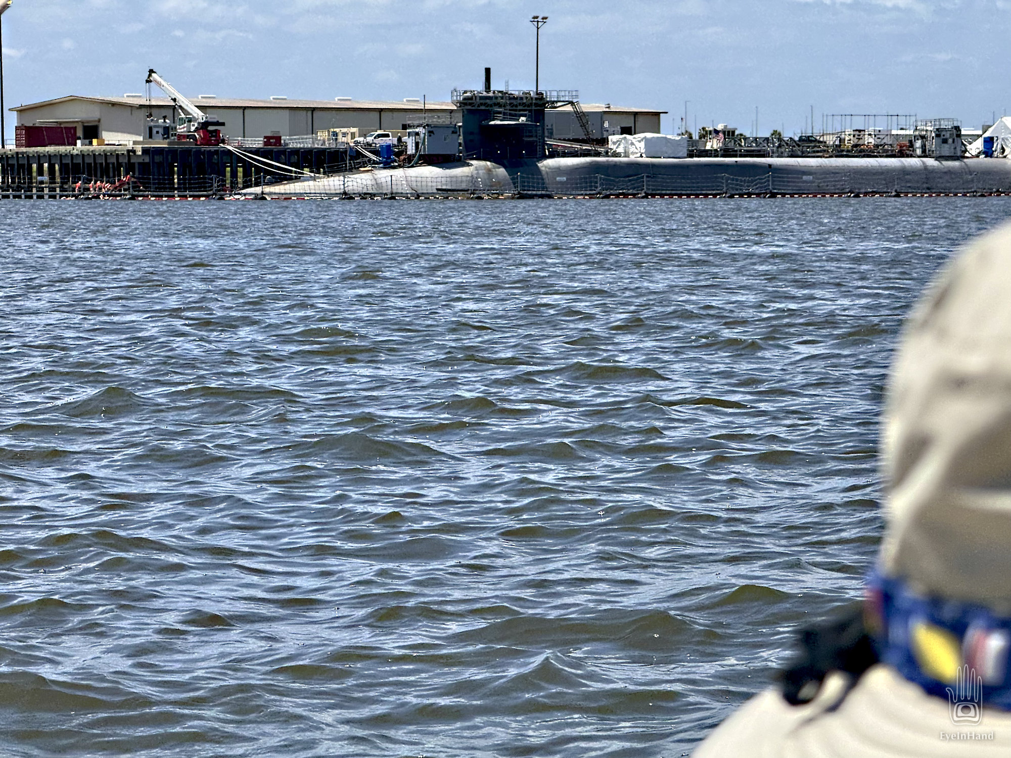
The marked route now carries us closer and closer to nuclear submarines with their pack of aggressive guard patrols. Doug has me looking for red markers with binoculars while he steers. A sub at the end of the dock looms larger and larger like a beached whale, and still we have to continue toward it.
“Here come the dogs,” says Doug. I put down the glasses and see two patrol boats prowling out from the base. They then stalk us like junkyard dogs. Doug waves to them in the most unthreatening way possible and tries to smile big enough for them to see. They do not wave back. We’re not liking this. I see the next red marker, even closer to the base, and say, “That can’t be right, can it? It’s way over there!”
Doug is trying to steer while looking over his shoulder, keeping an eye on the patrol. With all the twisting, the cushion he uses for a back rest goes over the side. The wind and tide push it merrily toward the patrol boats. It’s a new white cushion, one of a pair he bought just for this trip. He really, really wants that cushion back.
Too close for comfort, still in the ICW
“Doug, the only thing they’ll like less than you throwing cushions at them is us trying to fetch it. And I don’t think they are going to pick it up and bring it to us.” The nearest patrol is close enough now I can see that’s not a harpoon gun mounted in the bow pointed at us, it’s a really big machine gun. I don’t think they like me pointing a camera at them, either.
While Doug runs through scenarios that involve getting the cushion back without getting shot, I look back at the chart to figure out how this makes sense. I touch one of the little warning icons, which I assumed just says don’t piss anybody off here. In fact, it says, almost nonchalantly, the red/green markers reverse and switch sides right here at the base. We’re going the wrong way. We’re outside the channel, over a sandbar, and way too close to that submarine. No wonder the dogs are stalking us.
Our route following the “Red on Right” rule
Doug makes a 90 degree turn around Red 46 and points us at the nearest green 100 yards away. It’s shallow enough we can see sunlight on the bottom. We raise the centerboard halfway, and hold our breath until we clear the bar. Back in the channel I see the red marker we should have followed was bent over like it had been hit. No wonder we missed it.
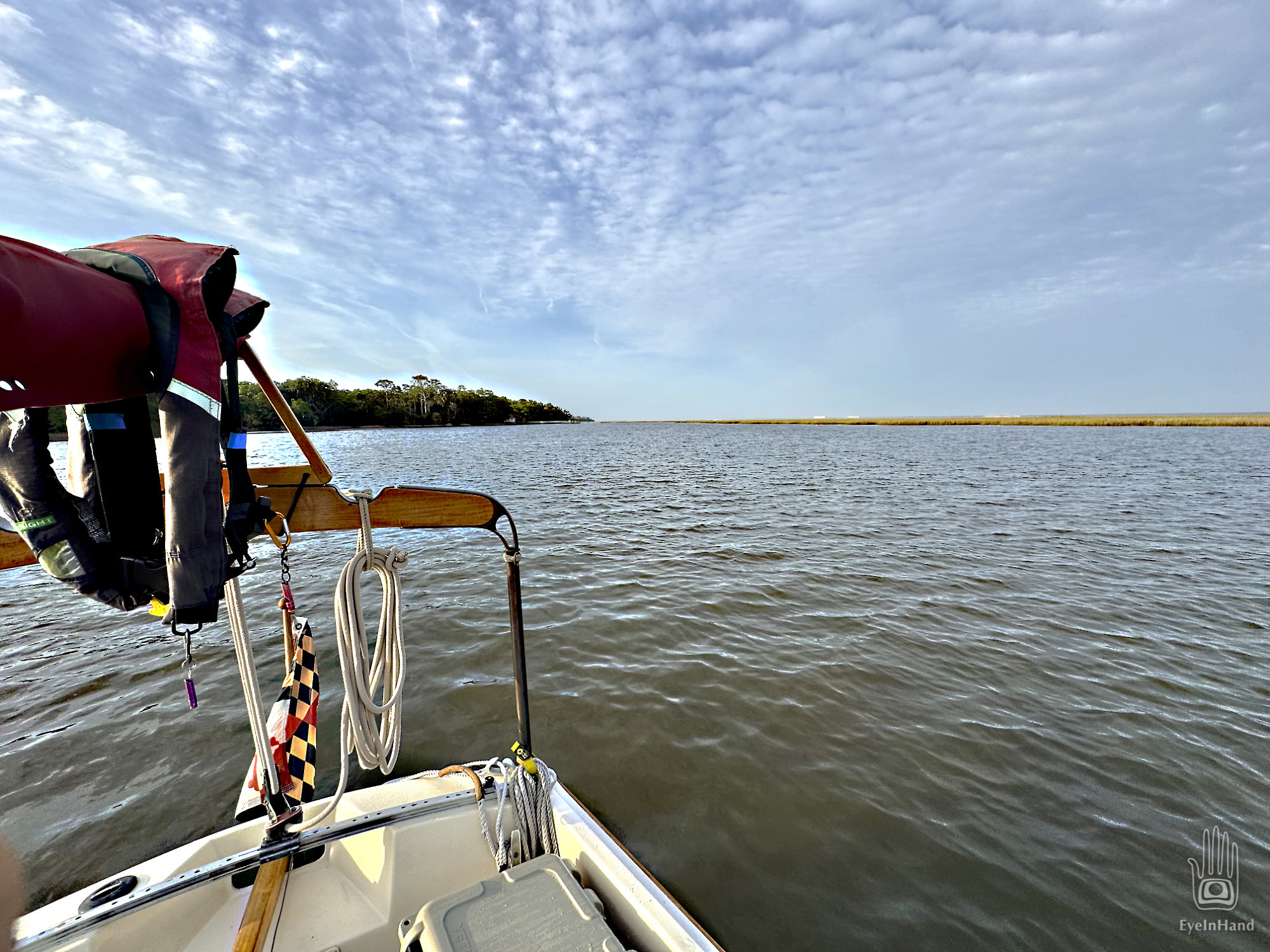
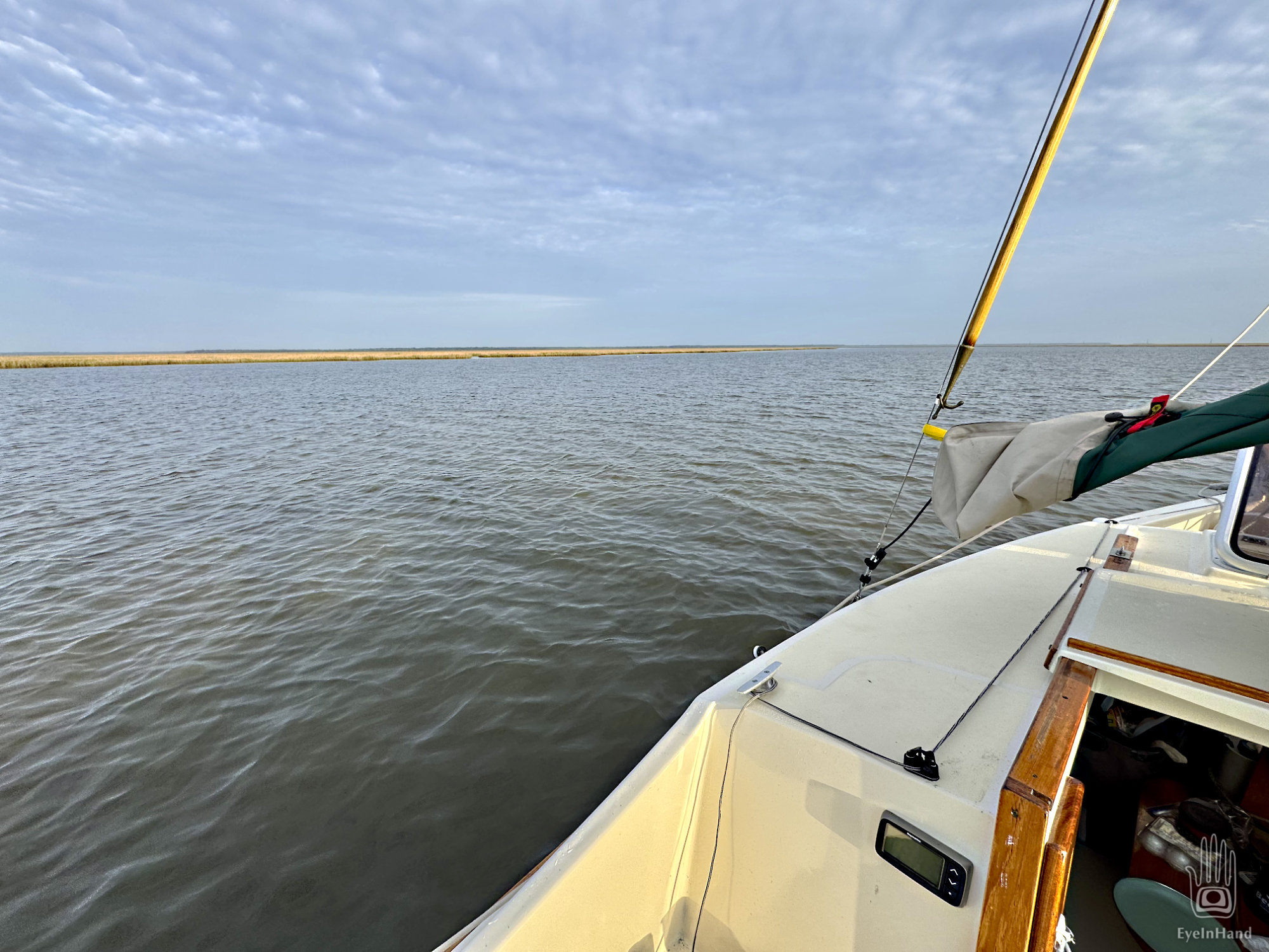
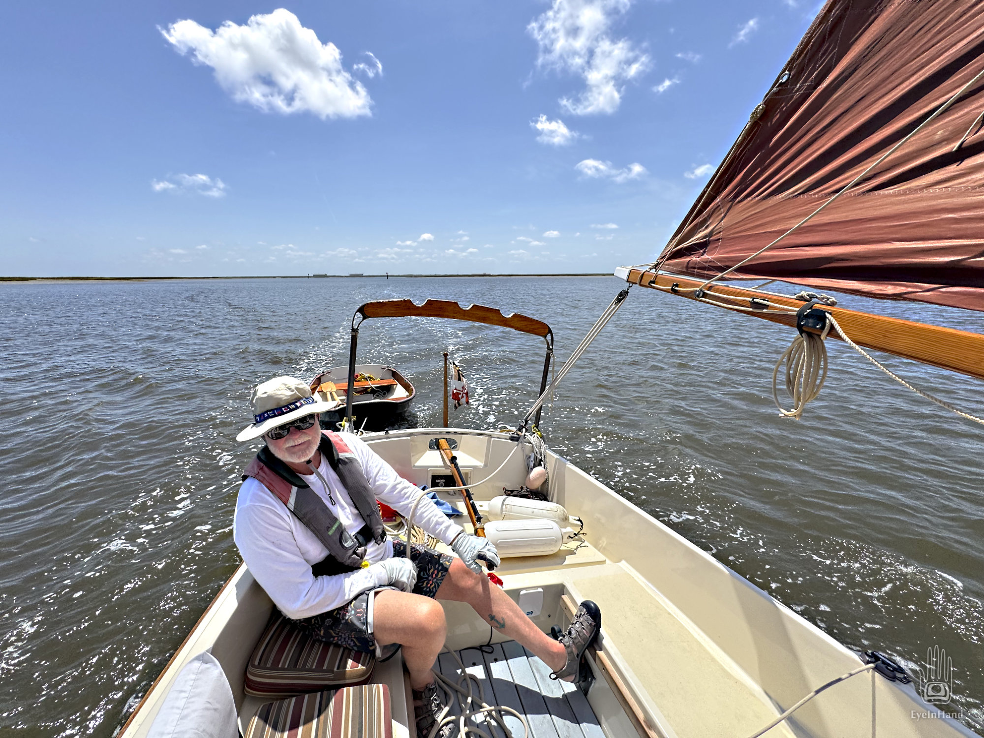
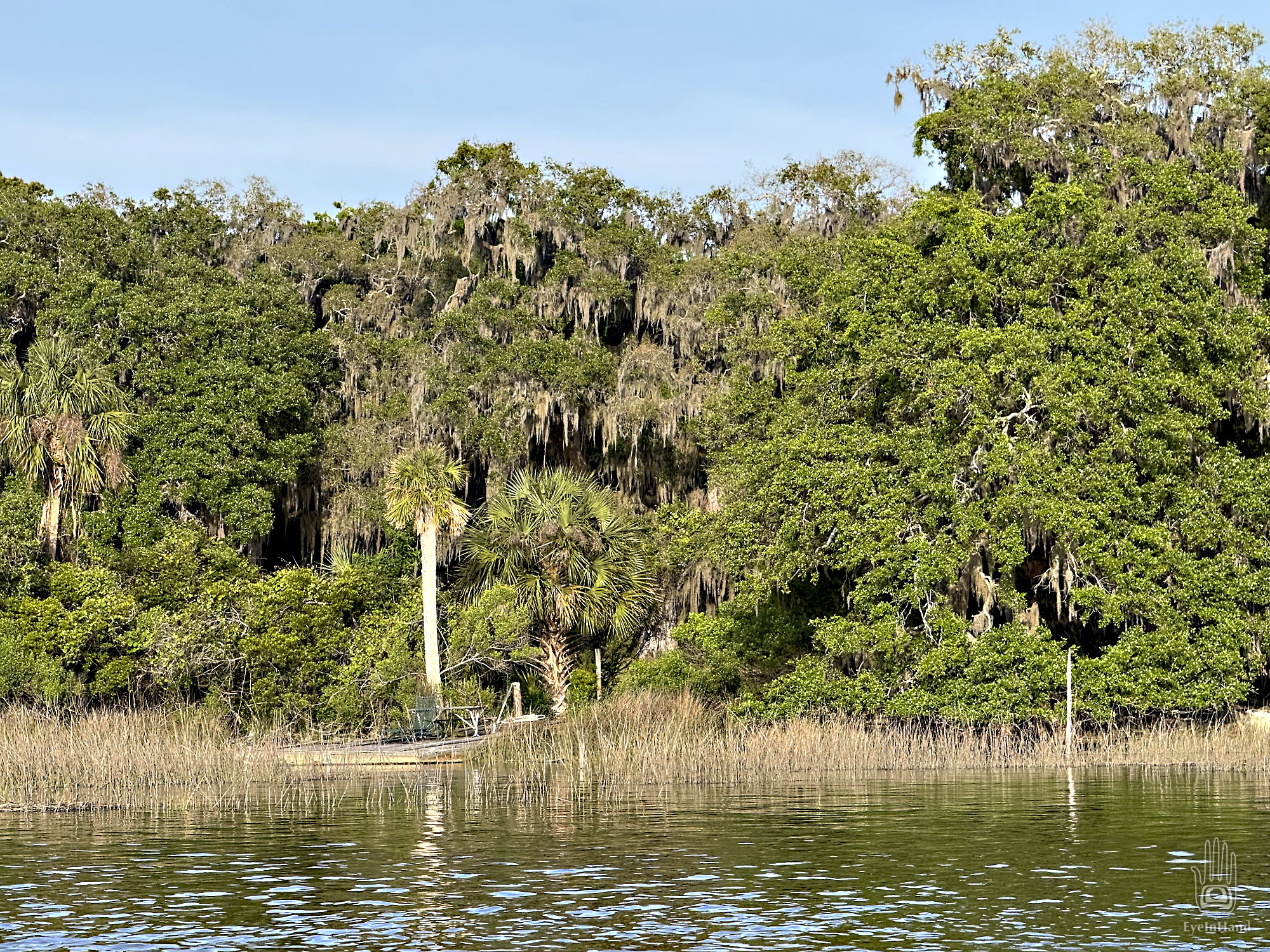
Everything improves the further we get from Kings Bay. Broad marshes fan out on both sides. A fresh breeze comes up from the east, and we have the best day of sailing yet. We aim for Brickhill River, a side creek that curls along the bluff of Cumberland Island. We can anchor there for the night next to Plum Orchard mansion.
We’re still sailing well, but Cumberland Sound narrows quickly. Sandbars emerge above the water on both sides, temporary buoys are canted over in odd places. Apparently things move around a lot here. Many warning notes in the charts about shifting shoals and boats run aground. This place is known as The Dividings. It’s what Steve Early and I have been calling the Head of the Tide; but in sailing logs for the past several hundred years these places are referred to as “dividings” – where opposing tidal currents meet, then divide and flow opposite directions. At such places, rivers peter out to narrows, and stalled currents let sediment settle out in bars and shoals. Which we now see everywhere.
We come to a sharp turn where the channel is only a few boat lengths wide. It’s at this exact point where two separate fleets ran aground in two separate wars, botching the outcome of battles. During the Revolutionary War, a fleet of British schooners came down from the north to meet a landing party at Amelia for an attack on the fort. But the schooners could not tack through the dividings here. They ran aground and remained stuck on the sand until the attack was abandoned. The same thing happened to Union gunboats in the Civil War.
We follow a friendly trawler we met in St. Augustine, and he leads us safely through the turns. We avoid getting stuck, but are so preoccupied that we miss the entrance to Brickhill River, which looks more like a little marsh creek. Catching our mistake we backtrack, then follow it another mile to arrive at the anchorage. It’s secluded, and protected by tall trees. The public dock is closed for repairs, so we won’t have any company. And we have time to row ashore for another hike.
At the dock and gatehouse we find for the first time, as we will for the next two days, that we have almost the whole island to ourselves. There’s no one here to greet us, take our entry fee, or oversee the exhibits. Dozens of park service vehicles are parked neatly in rows in a lot, empty. With all the DOGE cuts to National Parks, and everything here federally funded, there’s not even a ferry to bring people over from the mainland. We will not see a single Park Service employee in the entire two days we spend on the island, which is 20 miles long.
From the dock we walk a sand road through an arched avenue of live oaks. The nave of a living gothic cathedral. This, I thought, is what my art history professor meant when she said a forest is the inspiration for those arches and cathedrals. It was how you got Druids to become Christians.
Winding south, we come to the ruins of Dungeness.
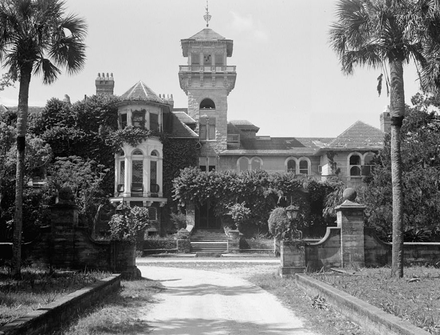
The first American to claim Cumberland Island was General Nathanael Greene, a Revolutionary War hero who served with Washington at Valley Forge. In honor of his service, he was awarded land near Savannah and most of Cumberland Island. Greene died of sunstroke at his Savannah plantation, Mulberry Grove. His widow married their children’s tutor and they moved to Cumberland, where they built the first Dungeness – a 5 story tabby mansion so tall it was used as a navigation landmark. The site chosen was the packed shell ring on a bluff over the inlet, a site sacred to the native Americans for thousands of years prior. “Lighthorse Harry” Lee, Revolutionary War hero (and father to Robert E. Lee, the Civil War general) visited the estate, fell ill and died. He’s buried here. Dungeness, the mansion, burned in 1866.
Oddly enough, it was on Greene’s Mulberry Grove plantation where the cotton gin was invented. That bit or technology turbocharged the southern slave economy setting the national stage for the next big conflict, the Civil War. After that war, half the island was owned by Confederate General William George Mackay Davis, cousin of Jefferson Davis. Scrambling to make a living after the collapse of the Confederacy, Davis wanted to make a resort of the island, giving tours of the Dungeness ruins. But his son, Bernard, accidentally shot and killed his young son in a hunting accident on the island. Distraught, Bernard later killed himself. The combination of tragedies led Davis to sell his part of the island, to Thomas Carnegie.
The increasingly mobile industrial classes, like those who came before, fell under the spell of the Florida land speculators. Carnegie bought Dungeness Plantation, of which he had never before heard nor seen, in Georgia, where he had no connections, from a former Confederate general whom Carnegie had never met. But his wife read a glowing article about the place in a magazine while visiting Amelia on their yacht. Another triumph of marketing for my copywriter friends.
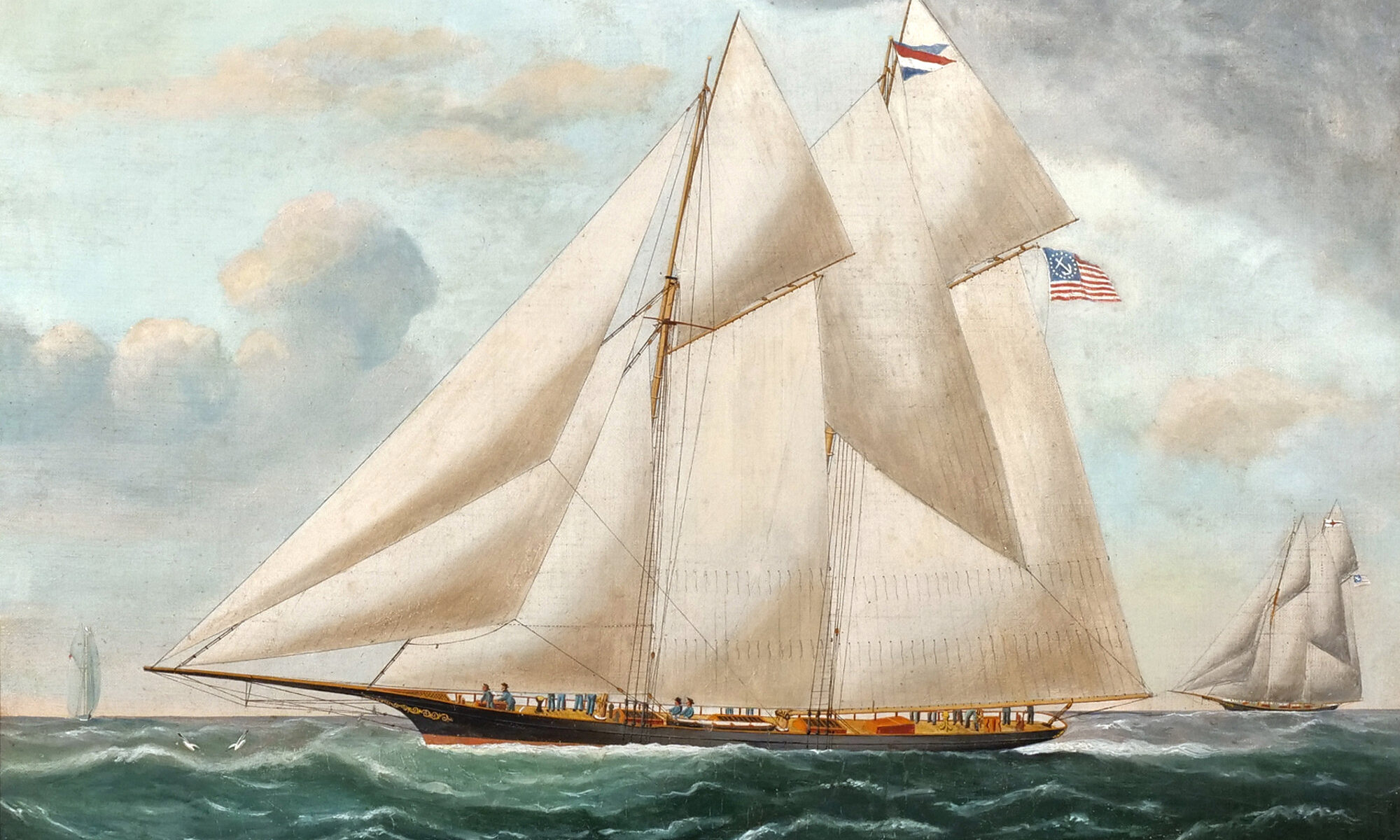
Dungeness before it burned in 1959, via Wikipedia
Thomas was brother to Andrew Carnegie. He was instrumental in building the vast family fortune that made them famous. When their consolidated US Steel was purchased through a consortium by J.P. Morgan, it was the most valuable corporation in the world, by far. Thomas purchased half the island from the distraught General Davis and gave it to his wife, Lucy, and began building a new Dungeness on the rubble of the old one. Designed by top architects of the time, it was a vast rambling affair, opulent with Tiffany glass and other elegant features, and remarkably was built and furnished in less than a year. Pittsburgh, with all the Carnegie Steel mills and forges, had become too polluted. Cumberland would be their healthy unspoiled new home.
Then Thomas fell ill and died.
His widow, Lucy Carnegie, hired her children’s tutor to manage the entire estate (there’s a couple of repeating patterns here, if you’re paying attention). William Enoch Page, the tutor, did an amazing job of this. Like crazy good job I won’t get into here – we’re talking water systems, electrical generation, elevators, food production, staffing, construction, etc., all of this back in the late 1800s. Leveraging the windfall from the sale of US Steel, the Carnegie holdings grew to encompass 90% of the island. Separate mansions were built for all of the married Carnegie children, with their spouses and offspring.
Greyfield Inn, originally one of the homes, is still privately owned and run by heirs of the family. We will see another of the homes tomorrow at the north end of the island.
Greyfield Inn, via historichotels.org
After Lucy Carnegie’s death in 1916, the estate moved into a complex family trust and things began to unwind. Heirs lived in their own mansions scattered across the island. Maintenance of the big house and operations became more and more onerous.
By the end of the Great Depression, no one lived in Dungeness full time, staff and caretakers dwindled to a skeleton crew. A single gamekeeper was tasked with guarding the whole island. One night he shot at a poacher, striking him in the leg. Soon afterward, someone shot holes in the Carnegie yacht and set it adrift. Weeks later, fire was set to Dungeness and it burned to the ground, leaving a shell of thick masonry walls. The wounded poacher, a known vengeful troublemaker, was accused but never convicted.
We stroll around the ruins to the view of the inlet, the view that made this such a strategic location. Feral horses graze on the lawn and drink rainwater from what had once been ornate fountains.
Further on we wander past remains of pool houses, stables, a dairy, then out toward the ocean beyond. The trail, a former road, runs through a maritime forest behind the dunes. Or did. In places the dunes have reclaimed the road as their own. Sand is deep and soft, and hot. After another mile of this we finally debouch onto the beach.
These southern beaches are remarkably wide and flat and hard. In the 1800s, it was popular sport to build sand boats and sail them at high speed for miles. This uncredited photo appears on the cover of “Cumberland Island: A History” authored by one of the Carnegie descendants.
The Florida State Archives has many similar photos taken at Ormond Beach. Honestly, it looks like fun.
Sand Yacht sailing at Ormond Beach, Florida
Far to the south we can just make out the mouth of the inlet. Rock jetties extend from the shore on each side nearly 3 miles out to sea, for the sea floor is just as flat as the beach. The jetties, with dredging, keep a channel open for passage of submarines, but the rocks are covered at high tide and lie in wait like alligators, ready to chomp an unwary wayfarer. Good example of an aid to navigation becoming a hazard to it.
Another example: Just up the beach we find one of the dredge buoys, its base buried in the sand. Probably broke loose in a storm. These things can weigh six tons. Wouldn’t want to meet one bobbing around in the middle of a dark night on a fiberglass pleasure boat – you’d crumple like soggy origami.
Here on the beach we find ourselves standing at a geographic oxymoron. This very spot on the eastern shore of the US is actually the westernmost point of the entire Atlantic Coast. We are in fact 600 miles west of the easternmost point, up in Maine. If you want to sleep late and still watch the sunrise over the Atlantic, this is the place to do it. When the sun comes up in Maine, you still have over an hour to wait before it rises here. The dredge buoy seems to mark the spot, like the famous bollard in Key West marking the southernmost point in the US.
As owners came and went, livestock was allowed to wander, or simply abandoned. Cattle, hogs, pheasants, goats, and a veritable zoo of exotic creatures remained behind and roamed free for centuries. Today a large herd of wild horses has free rein of the island. Up in the dunes we find a glossy stallion grazing on beach grass.
Another mile up the beach we reach the campground and find a handful of people, the first of the day. We take a dip in the ocean, take cold showers, and head back across the island. The forest canopy is like a big green tent, open underneath.
Striking the river on the west side, we head south on a trail along the shore. Nothing but birds and cabbage palm and Live Oaks draped with Spanish Moss. Finally back at the dock after a four mile round trip, we row back over to Tidings.
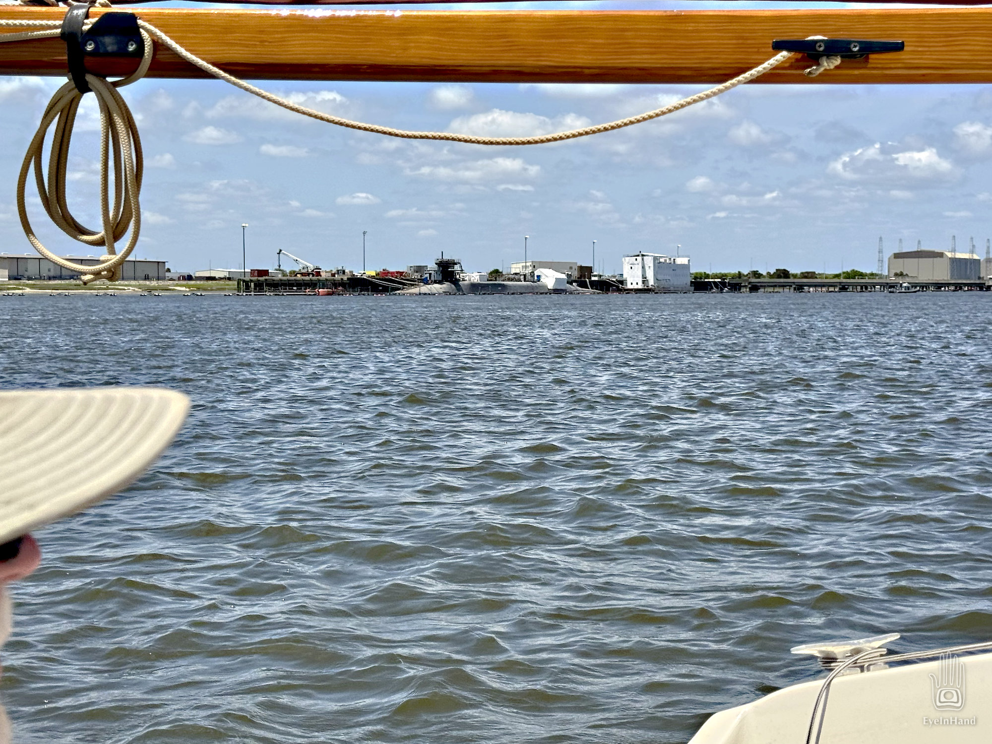
There we see a most unexpected sight: a nuclear submarine escorted by a retinue of attendant boats bristling with firepower.
This, we surmise, was the purpose of the “live fire drill” – a ruse, perhaps, to clear the inlet without giving too much away, as it heads to Kings Bay Sub Base across the river. It’s an Ohio Class sub, armed with nuclear Trident ICBM missiles. Each missile costs $70 million, and each sub carries 24 of them. The sub alone costs $3.5 billion. That’s a lot of money and firepower parading by as we relax on the deck of our humble little craft, powered by a one cylinder engine, dining on our one-pot dinner.
It feels like another anachronism, a legacy of the Cold War with its peak nuclear annihilation scare, back when neighbors built bomb shelters in the back yard. “Mutually Assured Destruction” it was called, or just plain MAD, if you were a peacenik. I remember doing Duck and Cover Drills in grade school, as if covering your head with a notebook would save you. An early form of Security Theater.
And here they are, still cruising the oceans half a century later, close enough for me to arouse suspicion in the twitchy escort boats. But the former panic has grown old and tired. We got used to it. We have new scary things to worry about now, though the old scary things never went away. Funny how that works.
Late that night, I wake to the sound of a low rumble and lights flashing in the porthole. Something big is moving upriver sweeping the sound with a blinding spotlight. Or some ship of the future brandishing a laser weapon.
From Spanish Galleons, to pirate frigates, Union gunboats, steam yachts of war-wealthy industrialists, to nuclear subs, there’s a pleasing continuity to it.
Sail track from Fernandina to Cumberland anchorage
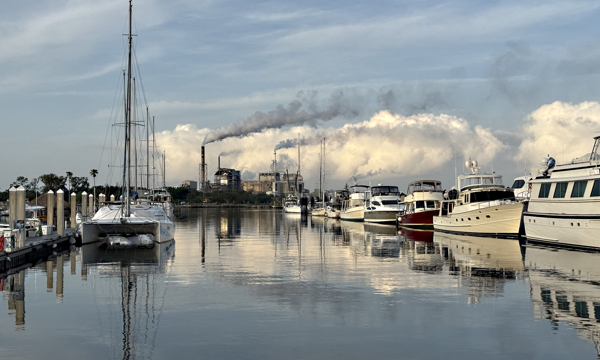
The ampule of sacred cow’s milk in hand, we head back to the harbor and prepare the ship to push north. We drift out on the last of the Amelia River, saluted by train whistles from the pulp mill on the north end – freight cars and conveyors and mountains of sawdust and ships listing with cellulose. A group of boating tourists motors by, lined up like ducks in a row. We’ve seen these all over Florida – little paddle boat size contraptions big enough for two. Big outboards on each one that weigh more than the boat, but a governor on the motor limits them to jogging speed. All hat and no cattle. In St. Mary’s Inlet, we catch a glimpse of Fort Clinch to the east on the tip of Amelia, sunbathers on the beach, and the wide Atlantic beyond.
At some indefinite but pivotal moment, we depart Spanish Florida and the expedition enters the wilderness of British Georgia. It’s like the wave of a magic wand. We know something of immense importance just happened; we just can’t say exactly when. Still, you KNOW something is different, if only an arbitrary border on a map. But we are on the right side of that border now, and welcome it.
Cumberland Island, Georgia
During the Age of Exploration, the St. Mary’s Inlet was a no man’s land between warring European kingdoms. It was the best deepwater port along a hundred of miles of coast between Savannah and Jacksonville. Strategically, everyone with a navy wanted to control it. Forts were built, defended, and lost on both sides of the St. Mary’s Inlet for hundreds of years. The Empire of Spain controlled everything to the south, all the way to the tip of South America. France and England wrestled over everything to the north, with England dominating the middle; but the hold was tenuous. In fact, Spain still controlled Florida all the way up to 1845, almost to the American Civil War. But the border was always porous here, fluid as the waterway. Skirmishes pushed the envelope north until the other pushed it further south.
This problem, as the saying goes, created certain business opportunities. When nascent America entered conflicts with Britain and her European allies, trade embargoes were enacted and blockades deployed to enforce them. But Spain, focused on extracting gold further south, stayed neutral in these conflicts. So enterprising frontier traders would bring goods down the Inland Waterway from southern Georgia – indigo, rice, cotton, timber, tobacco, etc. – and simply slip across the inlet to Fernandina. Effectively sashaying into Spanish Territory where there were no embargoes. From there, goods brought by Spain made their way back north via the same route. The town of St. Mary’s on the mainland of Georgia, and Fernandina on Amelia, though political enemies, in practice were international trading partners.
A military presence remains active today. Across the inlet to our left is Kings Bay Submarine Base. Hardened graving dock covers rise in the distance over the trees, the marshes, and Cumberland Sound. We enter the Sound and follow a creek to the right that runs north along the island, heading for an anchorage marked on the charts near the ferry dock. Two larger boats already there, but plenty of room. Which is good, because the 7 foot tides are strong and we need lots of scope to stay put.
A Coast Guard Pon-Pon alert comes over the radio while we prepare to go ashore. All boats are advised to vacate and avoid the St. Mary’s Inlet for the rest of the day for a “live fire drill”. “Glad we don’t need to go out that way today,” says Doug.
Kings Bay submarine base
We’ve heard so much about Cumberland Island we will spend extra time here – a day in the south and another on the north end. Variously claimed by colonial empires, a Revolutionary War General, antebellum plantation owners, a Civil War General, and the wealthiest industrial magnate of the early 1900s, it was a prize fought over in the last century by developers and preservationists.
I lived in Georgia when the island changed hands to become a National Seashore: from a private enclave of the uber wealthy family of Andrew Carnegie to become public land. It was a messy transaction that needed the work of state and environmental organizations, cooperation of the Carnegie family, and lots of money; but the deal eventually went through. Cumberland Island is now a National Park, one of the few that can only be reached by boat. Its relative inaccessibility, combined with the remote location far from urban centers, has done more to preserve it than any manmade controls ever could. Most of the island, abiding thousands of years of human history, remains remarkably unchanged.
Walk route, south end of Cumberland Island
Doing a bit of recon with maps, we see there’s a place near the beach on the ocean side of the island marked as having showers. So the rough plan is to walk the southern end of the island for a few miles, strike out east to hit the beach, and walk north along on the shore. We’ll go for a swim and shower off before walking back.
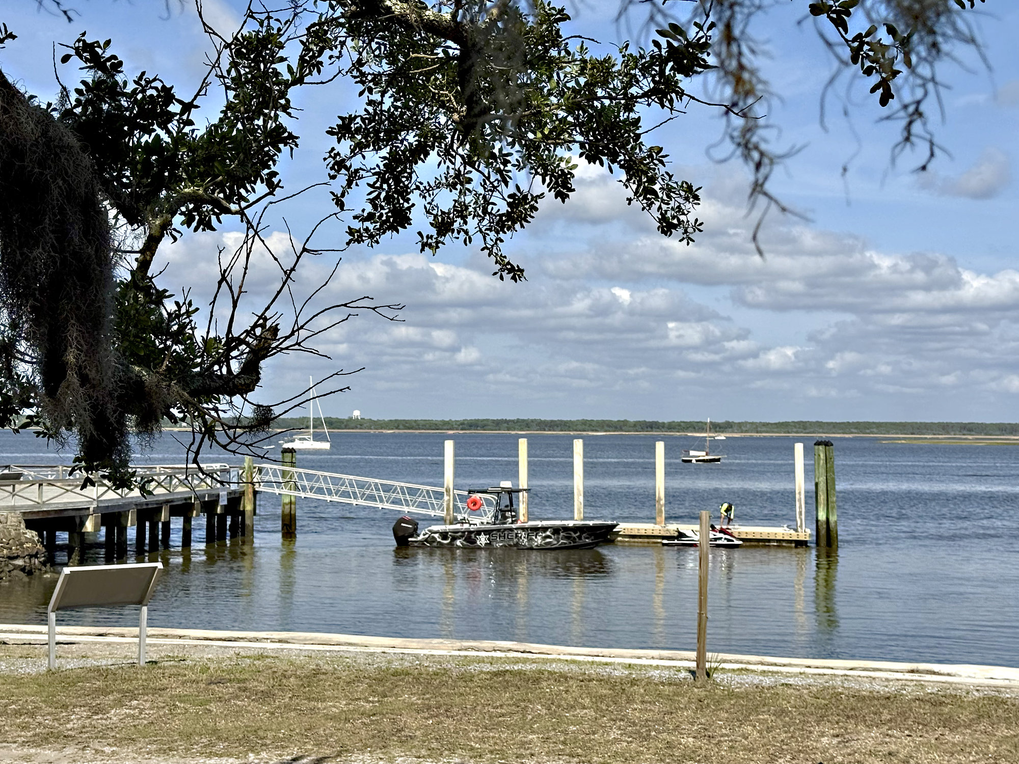
Ice House ferry dock, Tidings at anchor
We pack light – just some water, snacks, and a towel – and lower ourselves into PS, the tender tender, then row diagonally across the fast current for a couple of hundred yards to the dock, which screeches and groans against the tide.
It’s a clear cool morning and we’re feeling peppy. Today we will say goodbye to Florida – sayonara, see ya later alligator! When we cross the St. Mary’s River for Cumberland Island we’ll be in Georgia.
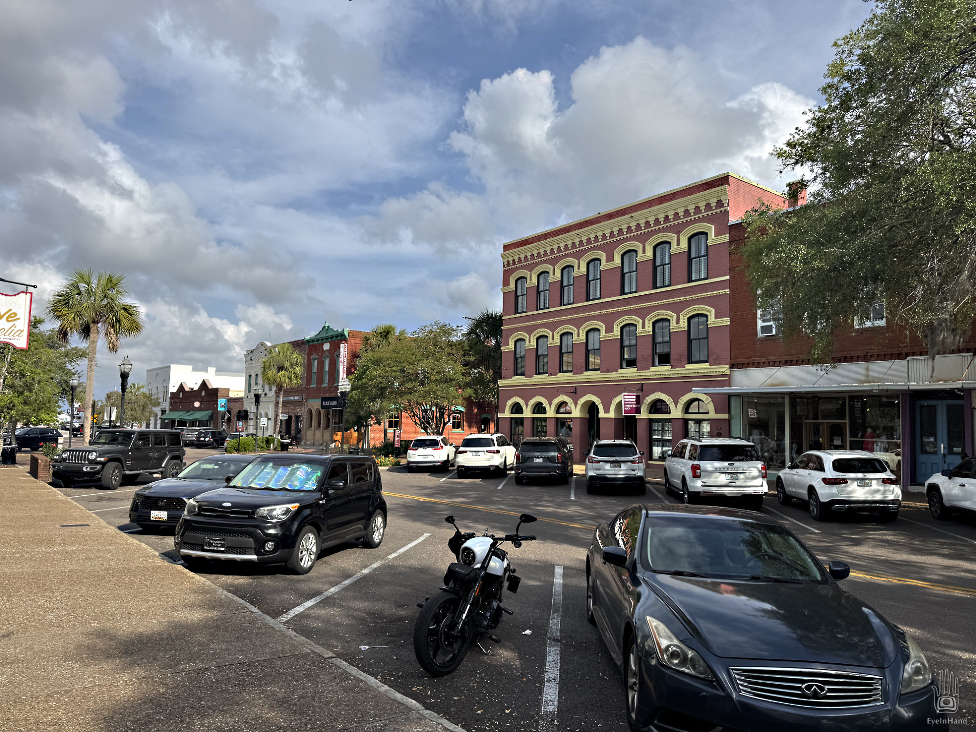
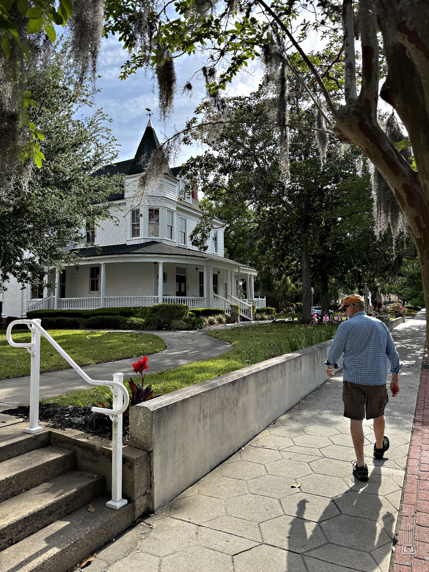
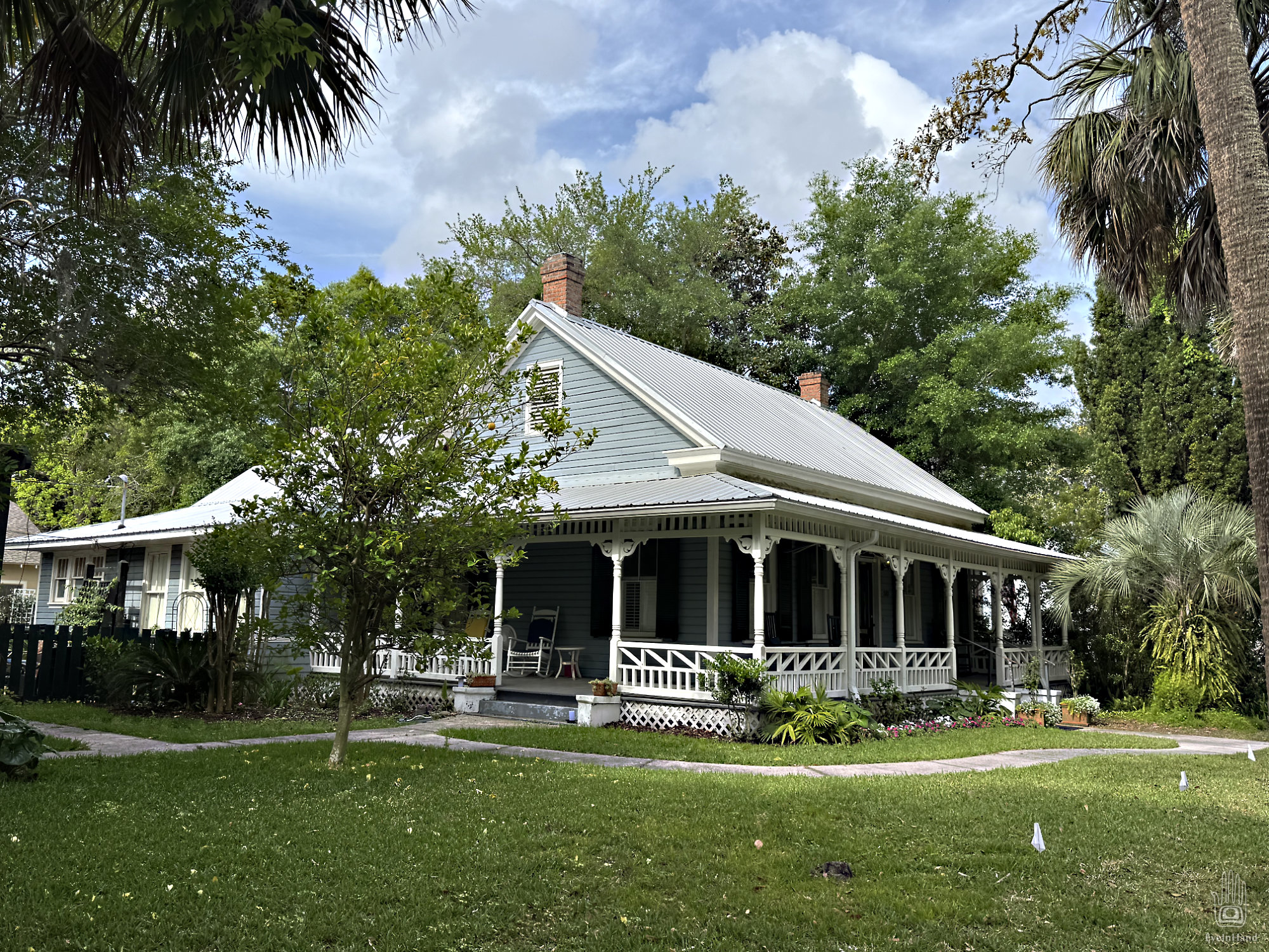
But first, we have to continue questing for Doug’s phone case. We get coffee and bagels in a busy little bakery on Centre Street, browse a fine independent bookstore, and start strolling east – past stately old Victorian homes and Spanish Moss draped parks.
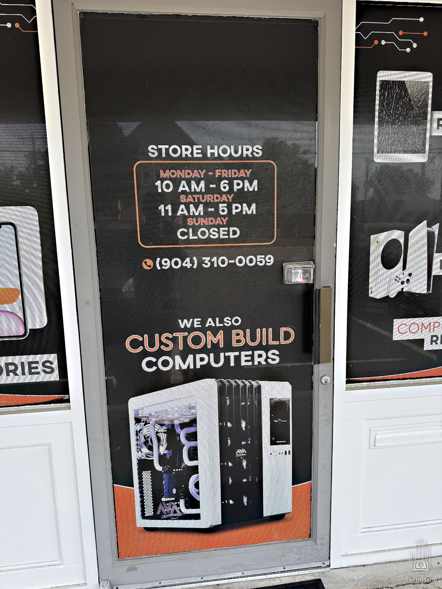
The quest is not immediately promising. We debate whether to consult a local oracle or perhaps just turn back. Then we come to a computer store in a former 7-11. Maybe here? Alas, it’s still closed at this early hour. Too bad, I say, because this is IT. Says IT right on the sign, “Your source for all IT needs.” I’m certain IT is inside.
I shake the door again, discouraged.
Suddenly a black van emblazoned with a hair salon sign drives up, and out steps a young native. (His mom the chauffeur?) He has metal tubes distending his ear lobes, shaggy black locks, and baggy black pantaloons, draped about the waist are chrome chains that swing extravagantly as he lopes toward us. Tattoos of arcane symbols festoon his arms. Perhaps he is a resident shaman. He approaches, nods, then stands between us as he begins to unlock the door.
Astonished by our luck, Doug and I exchange quick looks that say we agree it’s worth the risk, so I ask, “We were wondering if you might have a case to hold this Galaxy we’re carrying around in our pocket?”
“Which Galaxy?”
“A26”
“Nope. You might try the Target.”
“Bullseye. Where is that?”
He points vaguely off in the distance to the south.
We continue walking a few more blocks. But with nothing in sight, decide it’s too far. Maybe there isn’t such a place, and like other natives he’s just mis-directing us away. We give up and turn back.
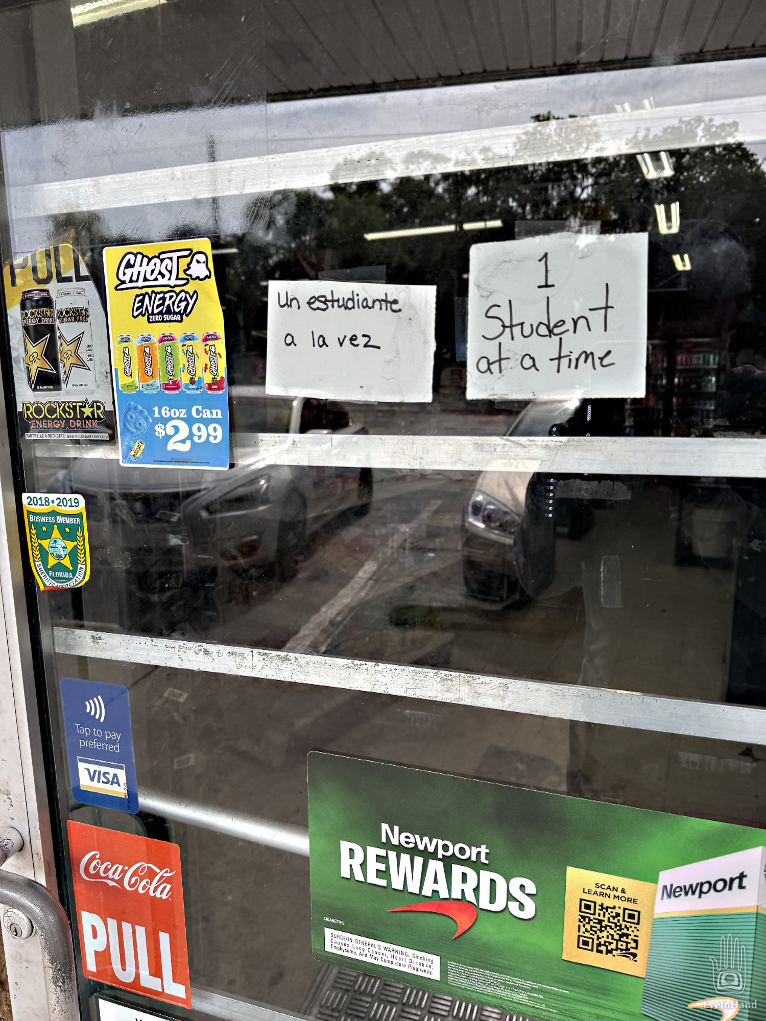
Off the main drag, in the quiet neighborhoods.
Circling back toward the harbor, we wander through the residential village, and soon come to a rustic Trading Post set off in trees. We stop and consider. Whatever they have in there must be very valuable – there are bars on all the windows and doors.
There’s a sign that says “1 Student at a time”. Maybe it’s the temple of a priest or spiritual guide?
Doug decides we need some supplies. He will forage inside while I make inquiries.
A bell jangles when we open the door. Inside is a curated collection of regional foods and dubious delectations: deep fried pork rinds, dried beef jerky (is it really beef?), pickled bird eggs, dried and salted sliced tubers. Live worms and minnows. There’s a strong odor of old fish. Deer heads and stuffed bobcats on the walls. Faded photos of hunters and fishermen proudly posing with their kills. Marvelous, really, but nothing we want for the larder.
Some sort of soothsayer is held captive in a magical cage made of thick glasslike crystal, apparently forced to watch over the trade goods. Maybe he is under a spell and imprisoned as punishment for offending a local chieftain. Caution is advised, I think. I have to speak to him through a slot in the translucent cube.
“Would you have anything that would hold a Galaxy?” Shakes head, does not appear to speak English. “The Fountain of Youth?” Again, shakes head. If it’s here, he will not divulge its location. Or maybe the spell has also made him mute.
Through pantomimes try to negotiate a trade for some cow’s milk. But he won’t accept the plastic cards issued by the bank of our king. Nor pieces of paper on which we offer to write our names. Digging into various pockets we find a few shiny coins made of fake silver and copper. These he will accept, but only for a smaller vial of cow’s milk. A sharp trader, this holy man.
We wend our way back to the harbor, ampule of cow’s milk in hand. The quest continues . . .