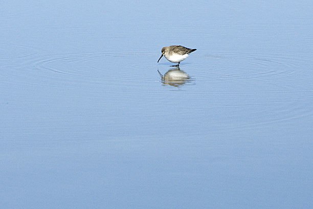
 Brickyard Point Landing, photo by T
The week following New Year’s was cold – record breaking cold – so it wasn’t the best time to visit the seashore; but that made it a good time to visit family. My folks now live on an island outside Beaufort, South Carolina, which is about halfway between Savannah and Charleston. When I was growing up we took vacations here every summer, back when the place was still a little wild, so we have a lot of memories scattered around the island. When the last of my siblings left home, my parents sold everything in the suburbs and bought a house there before real estate got crazy. Now my own kids have grown up spending summers there, too, and on lucky occasions like this one our visits overlap with my sister or brother and the girls get to see their cousins.
One of the tasks long on my list of things to do has been scouting out good launch and sailing grounds in the area. During the swelter of a Low Country summer, though, a kind of dreamy lethargy sets in. The heat and the sun and sound of the surf set you adrift at the liminal edge of a hazy consciousness with an almost narcotic effect. In that state, getting into a hot car for any reason takes an excess of will and effort beyond anything we can typically summon. A book and a nap seem very important by comparison. Sadly, that means (with some notable exceptions) there’s little we’ve explored nearby that couldn’t be reached on foot or seen from a bicycle. But this time, since it was too cold and windy to spend much time outdoors, Terri and I took a long drive one afternoon, poking around back roads, doing a little exploring by car.
I have launched directly from the beach here before, and expect to again when conditions are right. The sand is hard and flat at low tide, with such a gradual grade that when all the way out there can be a couple of hundred yards of tidal flat between the wrack line and the water. But it’s pretty easy to do with a small homemade hand cart. That’s one of the reasons I chose to stick with smaller boats – you couldn’t lift a bigger one off the trailer without help, let alone cart it over the soft sand to reach the hard. The waves are often barely knee high, their strength absorbed farther out by the shallow sloping bottom, so with a little care you sail directly out into the Atlantic.
 Dad helps with a beach launch of the first boat, a sharpie skiff, back in 2004.
There’s also a good new ramp on the nearest inlet to the north, giving easy access to marshes behind the barrier islands, or it’s just a short mile or two run in the other direction to the inlet mouth, then past a necklace of sandbars to the ocean. The island to the south is uninhabited, and the entire island to the north, where the ramp lies, is a state park that cradles a large lagoon. Both islands are still primordial palmetto jungle, full of wildlife. The inlet can be dicey, though. At slack tide it’s wide and flat and deceptively calm, really beautiful. But when the tide turns, 100,000 acres of wetlands drain through the narrow inlet, shooting out into the Atlantic like a spigot faster than you could sail against it, and I’ve seen standing waves over 4 feet high in the channel from the current alone, and that’s before you even reach the breakers. Add an unfavorable wind and you’d be in real trouble, so timing is pretty critical. The incoming tide isn’t so bad – worst case scenario is you have to ride the flood far into the marshes, then just avoid getting left behind on the mud when it’s time to ride it out.
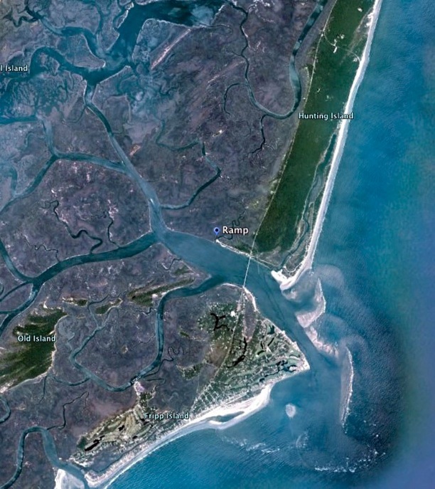 Fripp Inlet, and the new ramp on Hunting Island
But I’m familiar with these two sites already, and wanted to check out good spots farther inland. The old town of Beaufort is small but beautiful, especially along the waterfront, with several good launch sites, and will make for interesting cruising, as will several other spots in between.
There’s a lot of buried history around Beaufort, stretching back to the 1500’s. Much of it stays buried, or has been erased by time and tide. Occasionally, though, something pokes through, like a wreck exposed by a storm, and you realize how much has transpired beneath your feet. Once the natives and the Spanish were driven out in the 1600’s, the whole region was settled by English planters from Barbados. They grew wealthy raising sugar cane on plantations in the Caribbean, but quickly ran out of arable land. So they expanded here, bringing the plantation system with them, along with the slavery that made it possible.
The whole region just north Beaufort, comprising over 350,000 acres, is now known rather inelegantly as the ACE Basin. Named for the three major rivers that converge here – the Ashepoo, Combahee and Edisto – it’s one of the largest and cleanest freshwater coastal marshlands in the country. The 200 mile long Edisto, for instance, has never been dammed or even levied. Flat expanses of alluvial soil and abundant fresh water made it ideal for growing rice, and by the mid 1700’s the region was the second largest exporter of rice in the world – nearly half a million pounds in a single year – and, along with Georgetown to the north, made Charleston a center of commerce and culture, as well as the largest slave market in the world. That rich and complicated culture still permeates the region, in large part preserved by the descendants of slaves, but a few old families still remain who trace their history back through specific sailing ships all the way to Elizabethan England, and you find traces of its roots in the dialects, the food, and local crafts still.
But the Civil War brought the end of slavery, which is what made the labor intensive crop so profitable, and even in such an ideal location the loss of cheap labor and corresponding collapse of the economy brought rice production to a quick end. These expansive plantations, those that survived the War at least, fell quickly into disrepair and decay. The wet, frequently flooded land was not much good for anything else, and eventually the largest tracts were bought up cheaply by a relatively small number of families who managed and protected them for generations as private game preserves. Many have now been donated and combined into a network of Wildlife Refuges.
This will be a very cool area to explore, and one for which these boats are ideally suited. Every little side road seems to end in water, many of which are simply the centuries old raised berms that separated rice fields, and many of those have a launch site providing access to miles of winding waterways. The upland fields have grown up in 100 year old Cypress swamps, and it’s very strange to stand in one and watch the floor of the forest flowing back and forth with the tides. The lower coastal fields are still flooded, and, with the remnants of rice and other forage, they’ve become ideal havens for migrating and resident water birds.
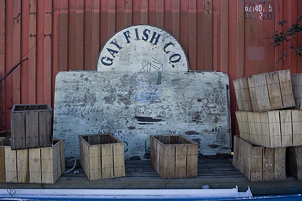
Other roads end in avenues of massive Live Oaks with a 300 year old plantation house at the end, and still others lead to larger, deeper river channels, some lined with docks where the local shrimp fleets tie up, where you can buy seafood right off the boats. A tempting stop on the way home, for sure. In all there are years worth of exploring to do here.
 One of Gay’s Shrimp Fleet. The movie “Forest Gump” was filmed here and nearby.
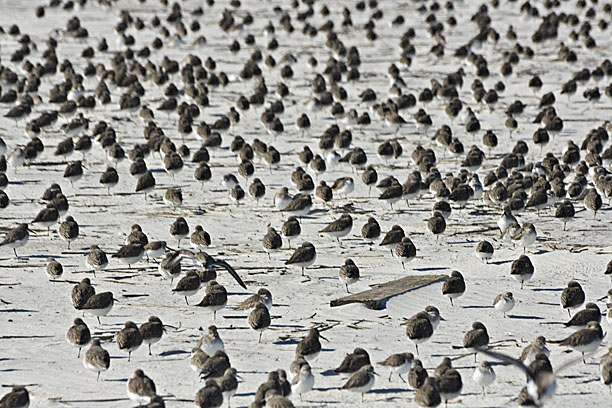
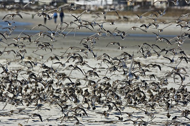
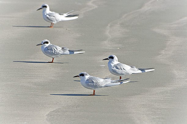
We did finally get out to the beach a bit one afternoon when the wind died down. There were flocks of Dunlin and Terns keeping the Gulls company. Maybe we can make another trip down next summer, with boats in tow. If not then, soon.
melonseed skiff, mellonseed skiff, melon seed, mellon seed


