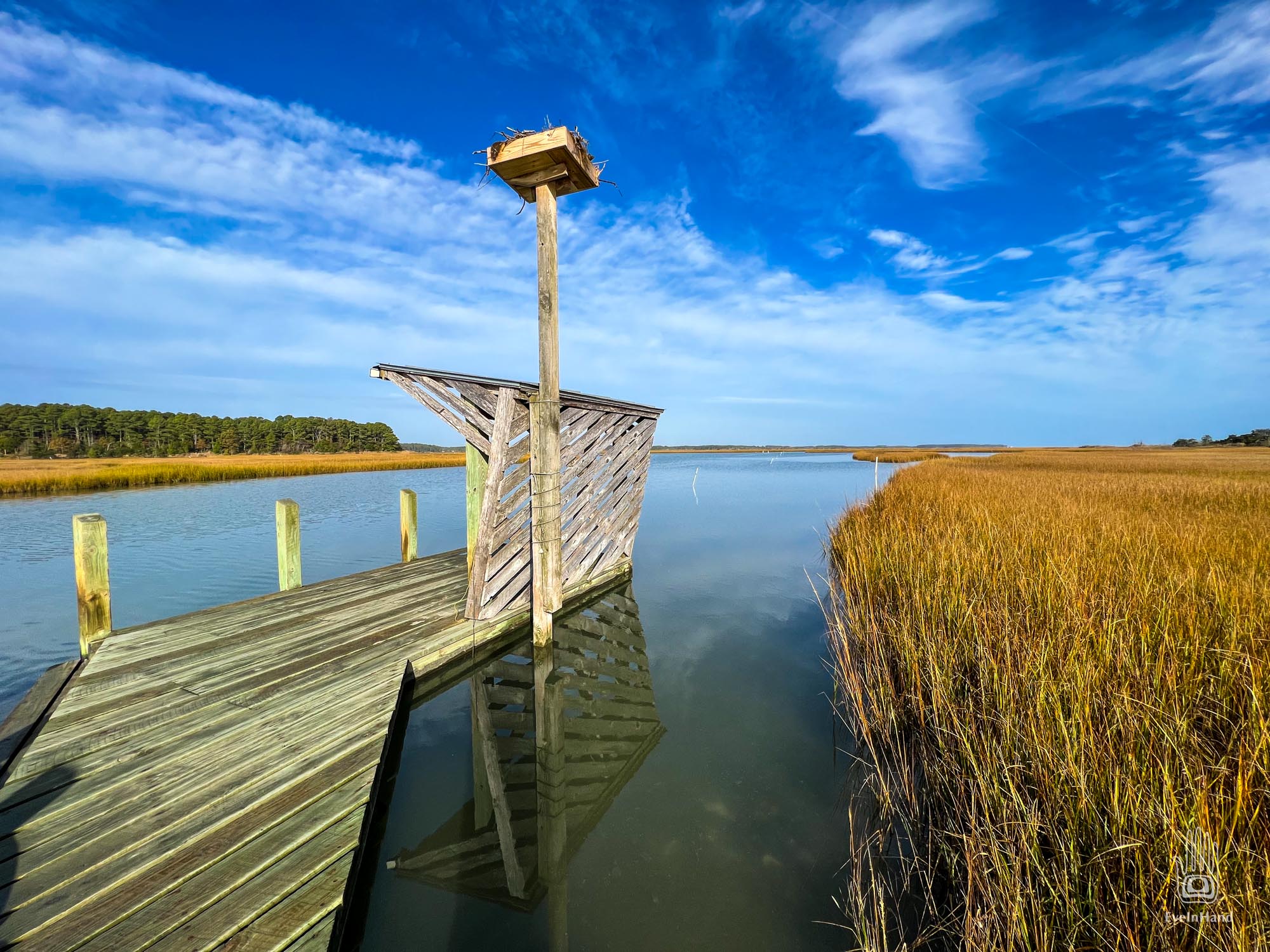
Went for a short paddle late in the day. The leaves are just starting to turn. Had the whole place to myself.
Found a hornet nest hanging over the creek. Empty, fortunately. Took it home to add to the collection.
These nests are made by bald-faced hornets. Their life cycle is fascinating:
It starts with one fertilized queen choosing a location for the nest and making a few cells with chewed wood pulp. She lays eggs in these cells, which hatch, and she raises them herself. Those offspring become her workers, who build more cells for more eggs, feed their younger siblings, and defend the nest. Every 20 days, a new generation of offspring comes online as the new adults join the workforce. The entire hive is offspring of the original queen, which by late summer can be 1000 strong.
Then the queen switches gears. She lays some eggs to hatch as males and a few new queens. These queens mate, fly off, and bury themselves in rotting logs where they overwinter. The rest of the hive then dies. In the spring, the mated queens emerge, and the cycle begins again.
Because this nest is not yet tattered by winter storms, it must be from this year’s brood. Somewhere nearby, young queens are bedded down waiting for spring.
Little Snow Whites, waiting to raise their own dwarves.
For those not interested in the details, here’s the video:
For years we used a Subaru Forester as a utility and travel vehicle. We could throw kayaks on top and bikes on the back, or haul a boat or utility trailer. Apparently, adding in coolers and camping gear, and us, far exceeded the load capacity it was designed for. This spring we broke both rear springs and struts. I got a finger wagging from my mechanic.
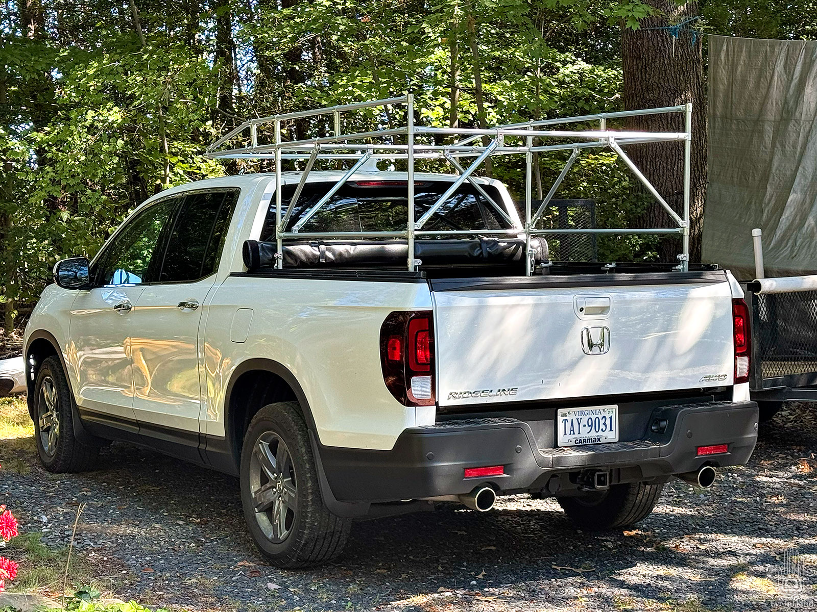
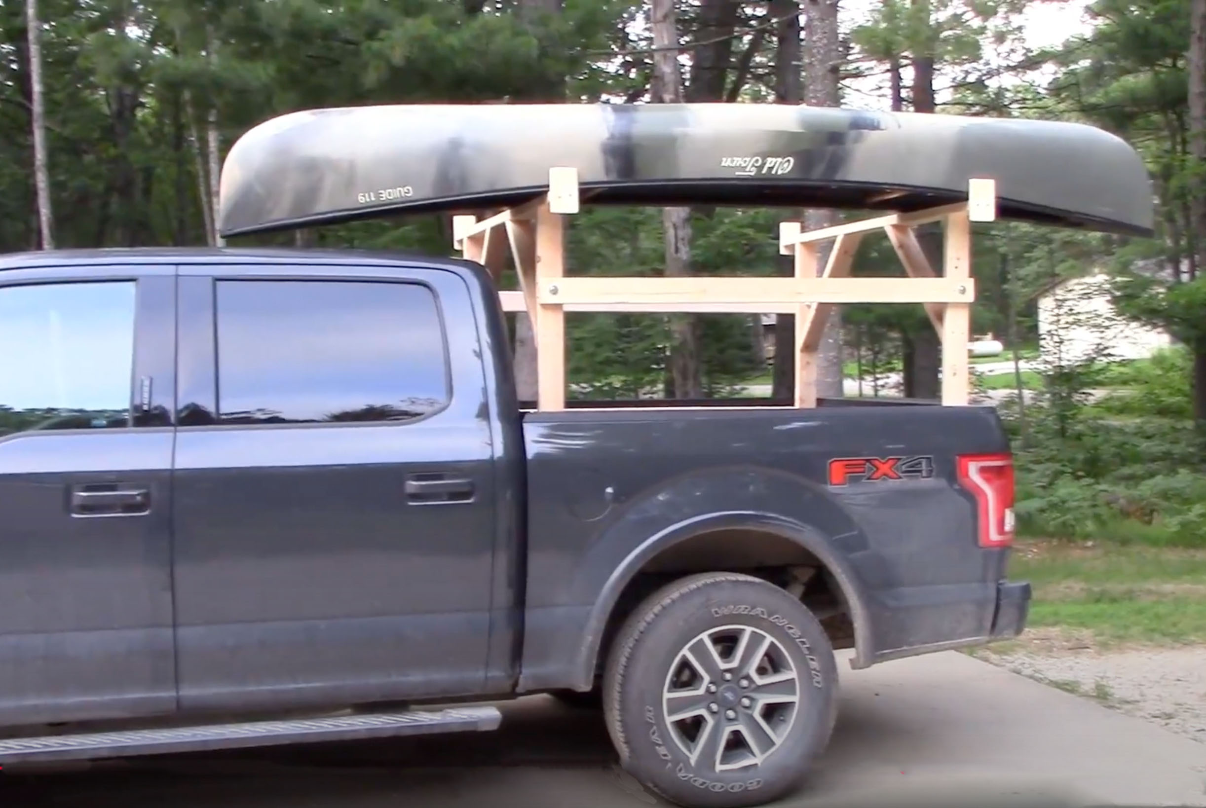
So we traded in the Subaru for a used truck that could handle the loads – a Honda Ridgeline that we’re really happy with.
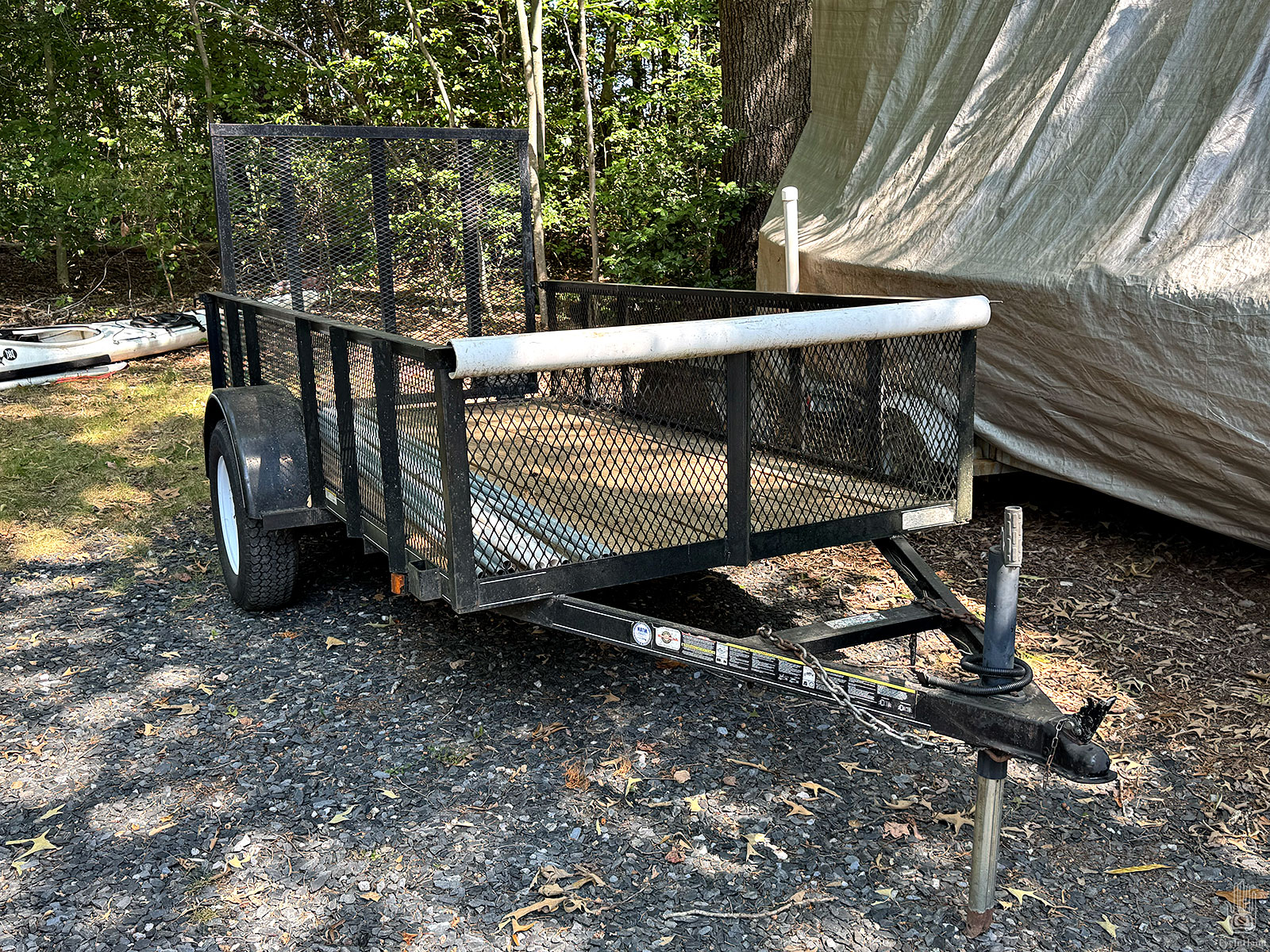
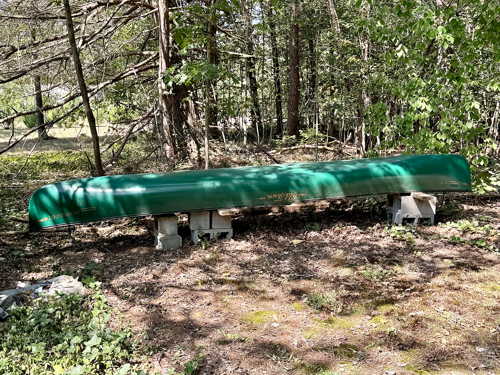
The bed is too short for 17 foot boats, though. It came with a soft tonneau cover, but no roof rack. I could use the 3 ton utility trailer; but many of the local river launches aren’t big enough for that. And hooking up the utility trailer means no boat trailer, or bike rack. We need something more compact.
I looked at off the shelf ladder racks. These are heavy duty steel structures geared toward construction work, meant to stay permanently installed, which means wind noise and a hit on gas mileage all the time, whether you use them or not. It would also mean removing the bed cover. What we need is something lightweight for the kayaks and occasional long lumber, that’s quick to install and remove, so is only on the truck when needed.
Example of a perfectly serviceable wooden rack
The obvious quick and cheap solution is a homemade rack made of 2x4s that just sits in the bed. You can find examples of these online, many are well done. I don’t have a garage to store it in, though, so after sitting out in the weather I’d have to rebuild one every year, or disassemble it for storage. Pressure treated lumber would help with rot, but is heavy. All little annoyances that add up to too much hassle to just go for a short paddle or to fetch something from the lumber yard.
Searching deeper for ideas, I found a small company called Maker Pipe. I came across them years ago when they were running a successful Kickstarter campaign. They manufacture connectors to build all sorts of things out of EMT Conduit. Seemed like a cool idea at the time, but I had no idea they had spun up into a permanent business. Good for them! They’ve taken the idea further. They now make a variety of connectors for different needs, and their website and Youtube channel are chock full of useful fun ideas and helpful info, all geared to small projects like this.
EMT Conduit is galvanized pipe used for running electrical wire, especially in commercial construction. It’s mass produced in 10 foot lengths, which keeps the price low, and is readily available at any hardware or big box store. It’s rigid and strong, bendable, cuts with a simple pipe cutter, and because it’s galvanized inside and out, is rust proof. Maker Pipe’s connectors are also galvanized, so anything you build with these components can stay out in the weather. The whole idea was interesting enough to give it a try.
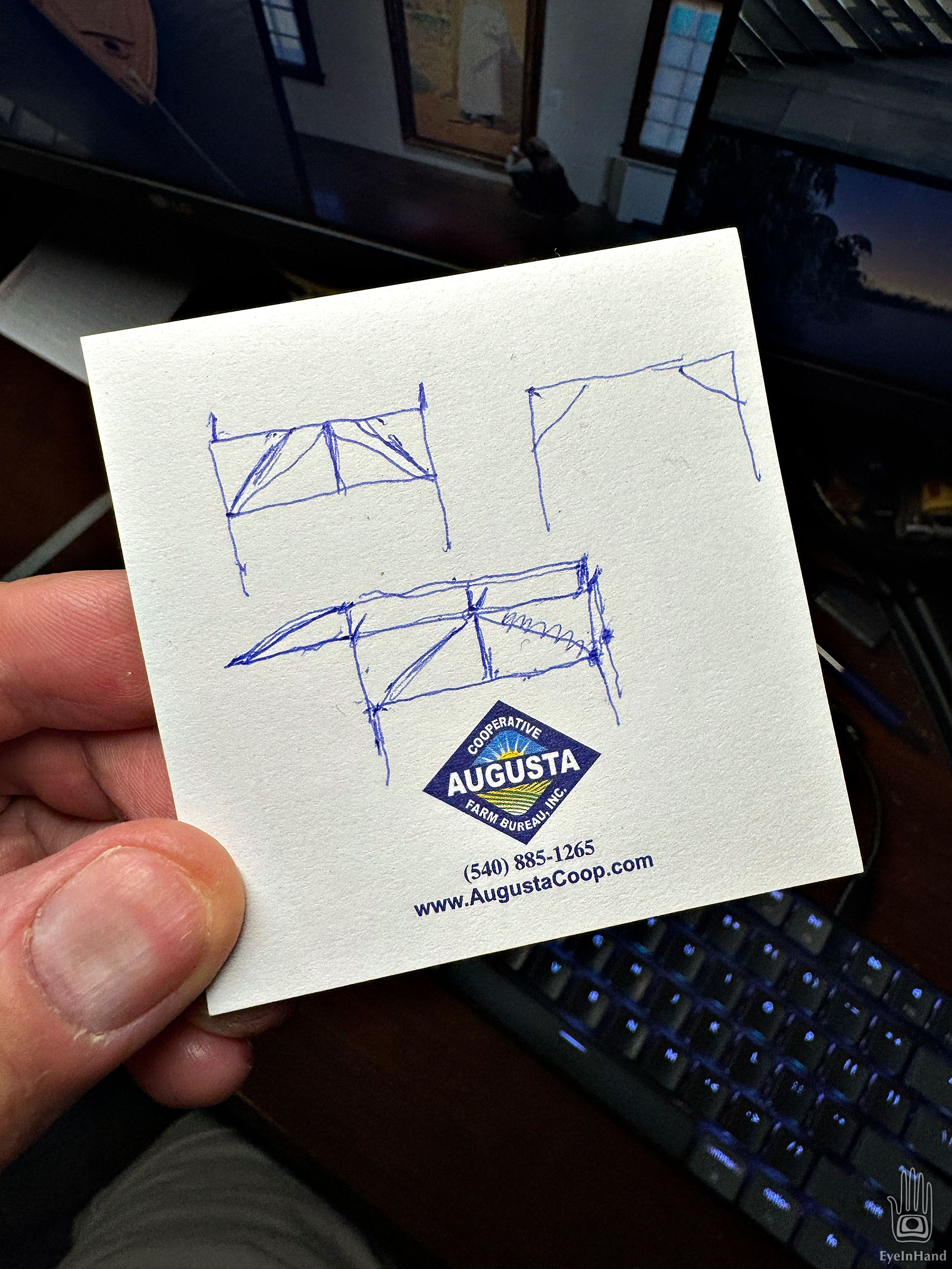
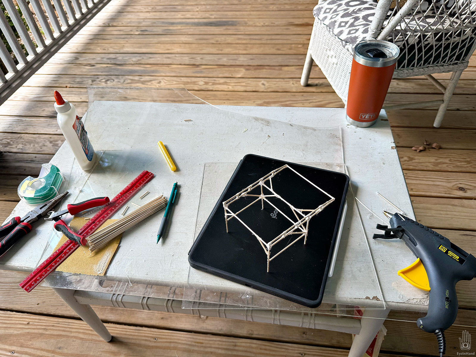
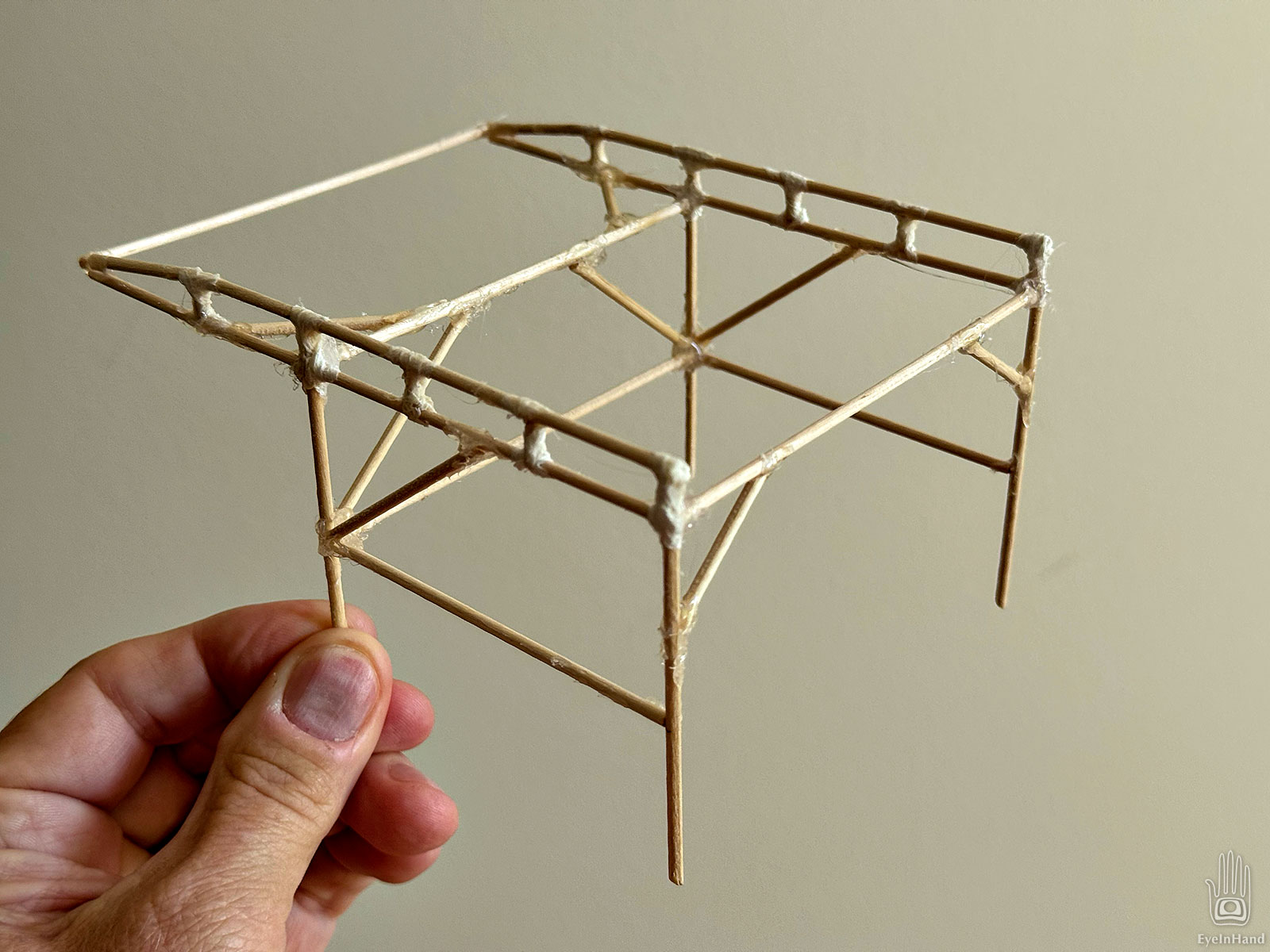
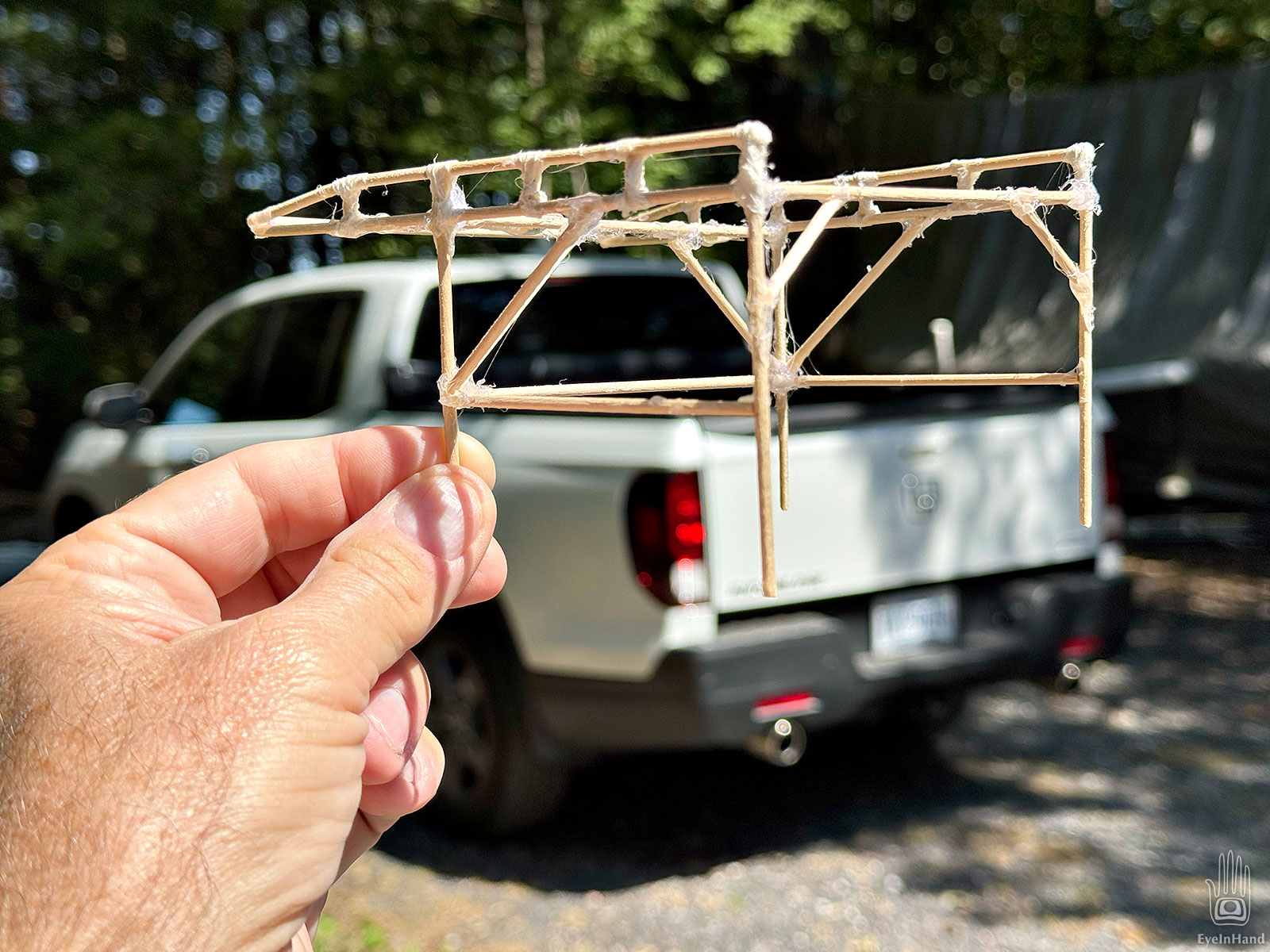
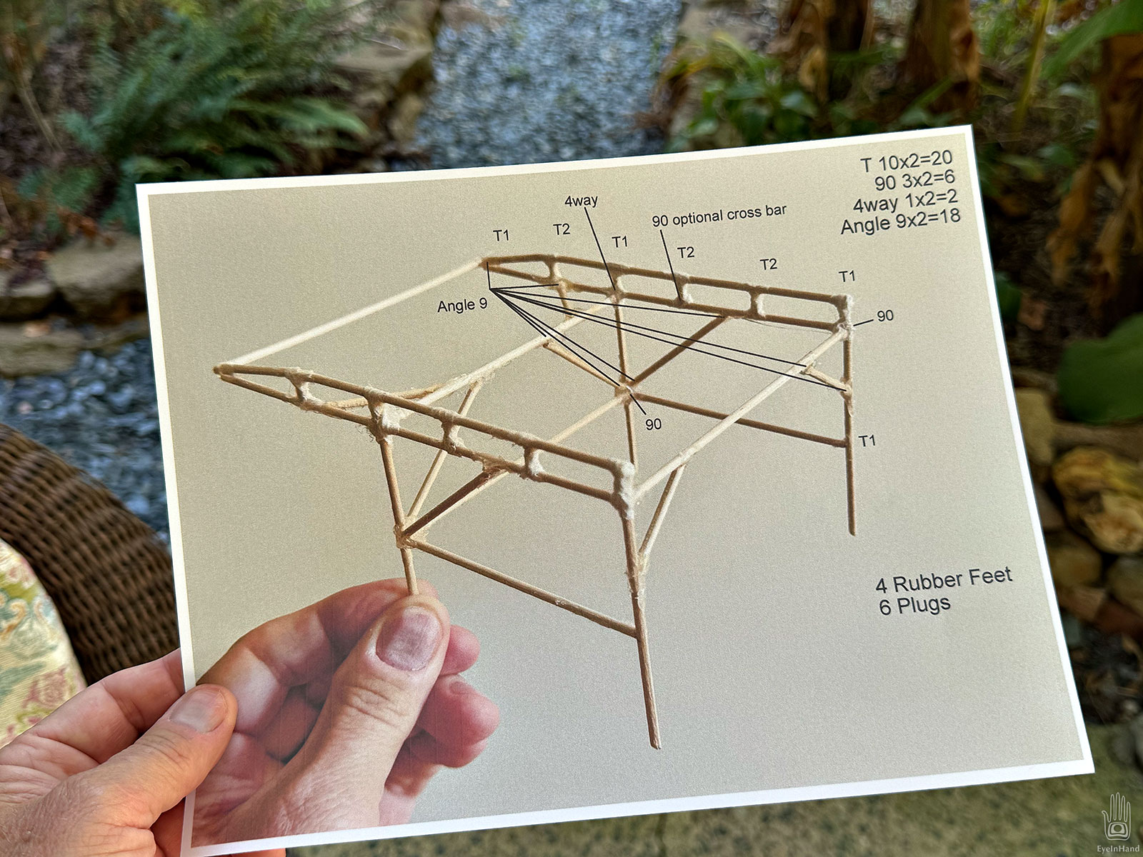
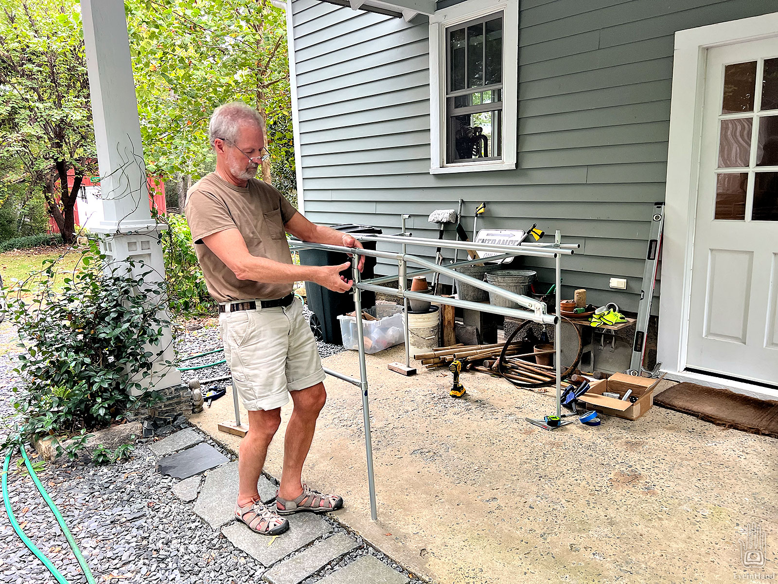
I started with a sketch, then made a model with sticks and hot glue to see how it would all come together.
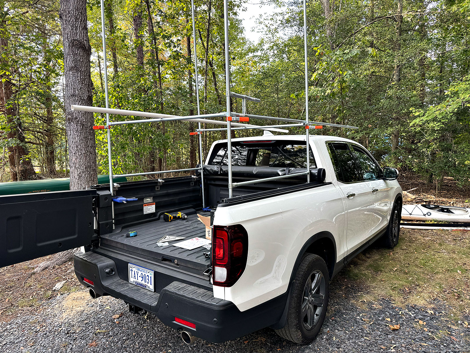
There were some things to sort out, like access to the trunk, leaving the rolled up cover in place, clearing the roof and shark fin antenna, etc. Then I printed a diagram to count up the various connectors and pipe needed.
Initially, I was going to use 1 inch conduit. Based on some fun non-scientific tests by the Maker Pipe team, it’s roughly twice as strong as ¾” pipe.
But 1″ pipe is also twice as heavy. Doing a little math I realized it would be pushing the limit of something I could lift and move around easily. Since I still have the utility trailer for heavy duty jobs, going lighter for this rack makes more sense.
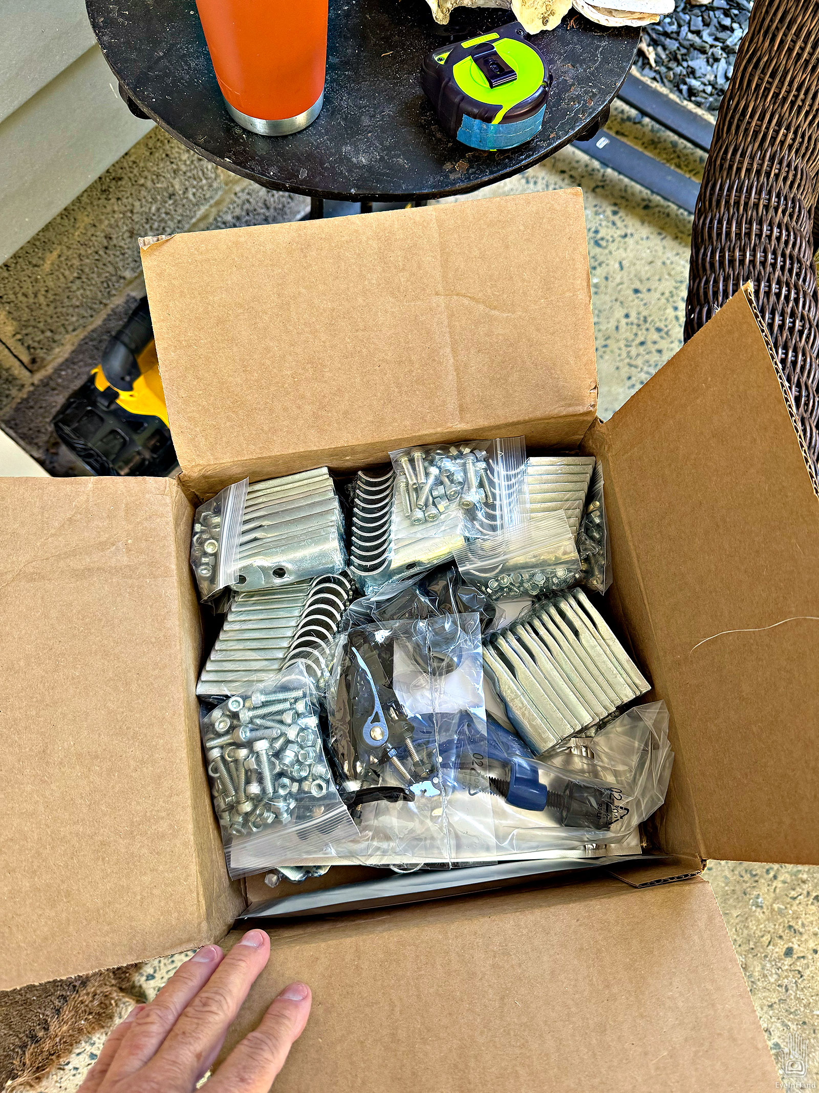
The box of connectors arrived in a few days, everything nicely packed.
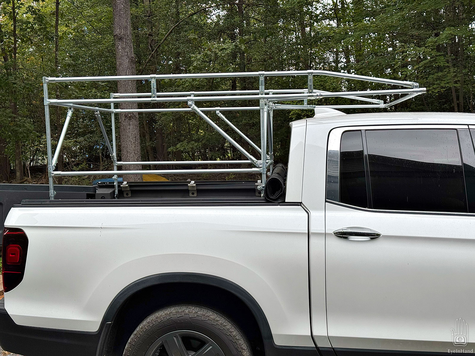
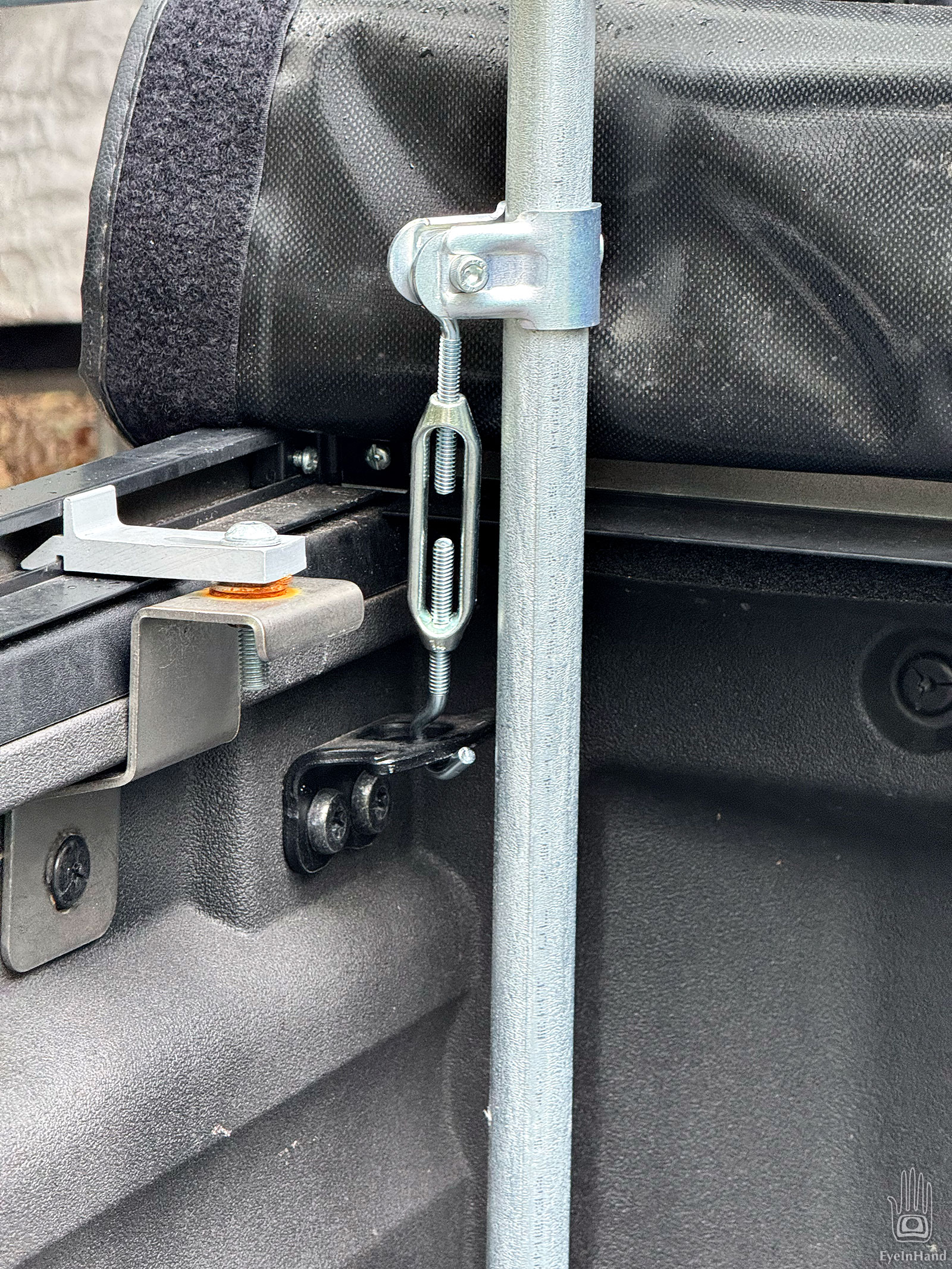
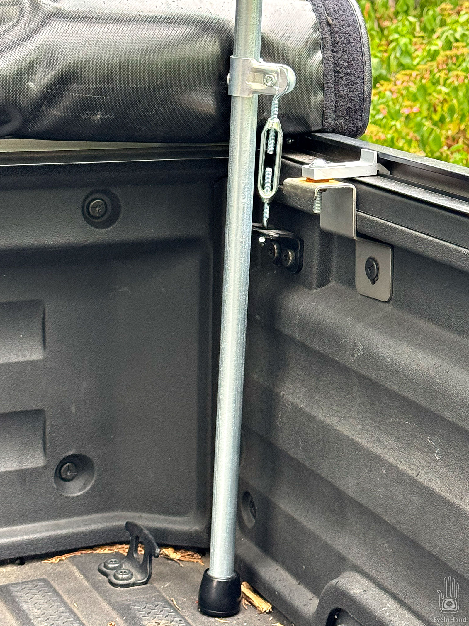
I did some mockups on the truck with clamps and pipe to get final measurements. Then the whole thing went together in couple of hours. Only tools needed were a pipe cutter and a 5mm hex key Allen wrench.
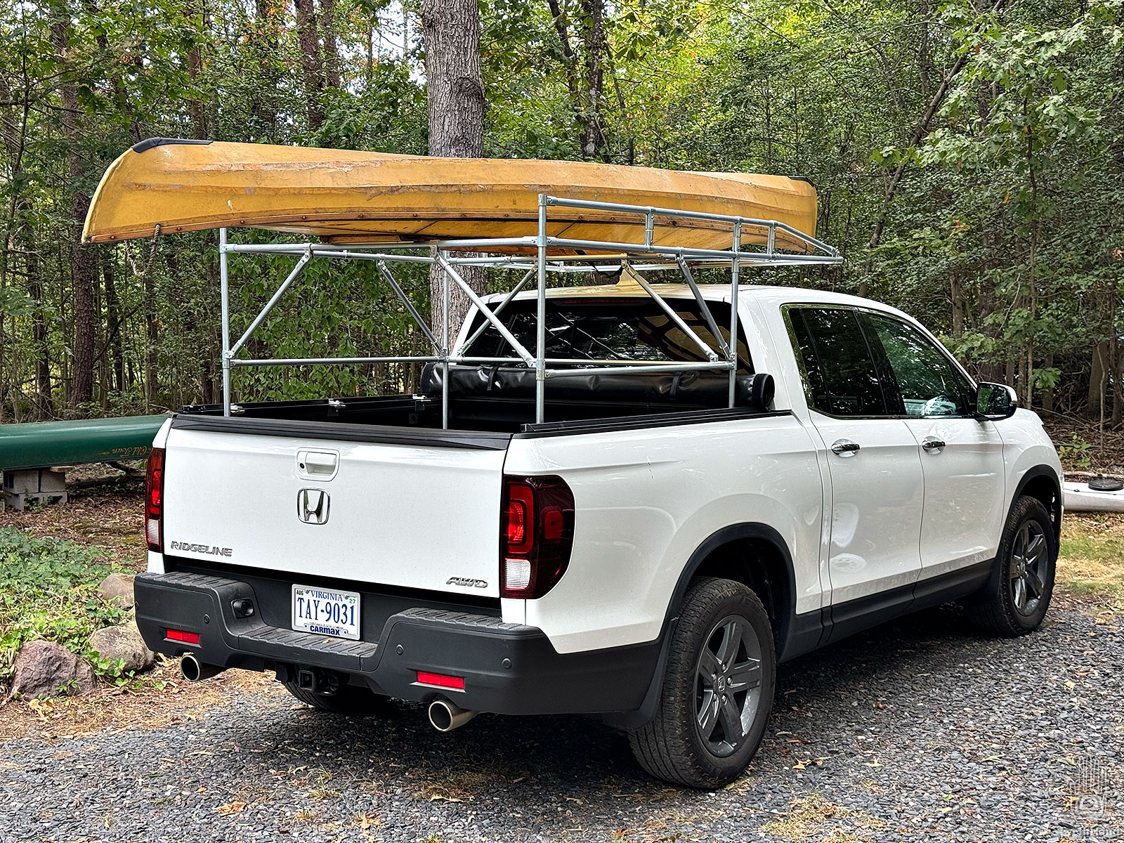
Next day I tested the fit and locked it in with turnbuckles to the existing tie down cleats in the truck, and went for a drive. There’s some wind noise at highway speeds, but not as bad as expected.
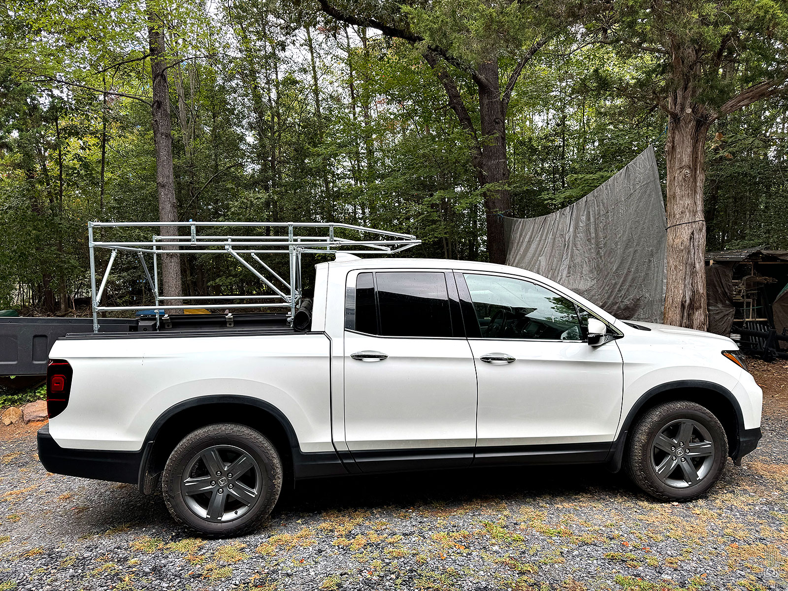
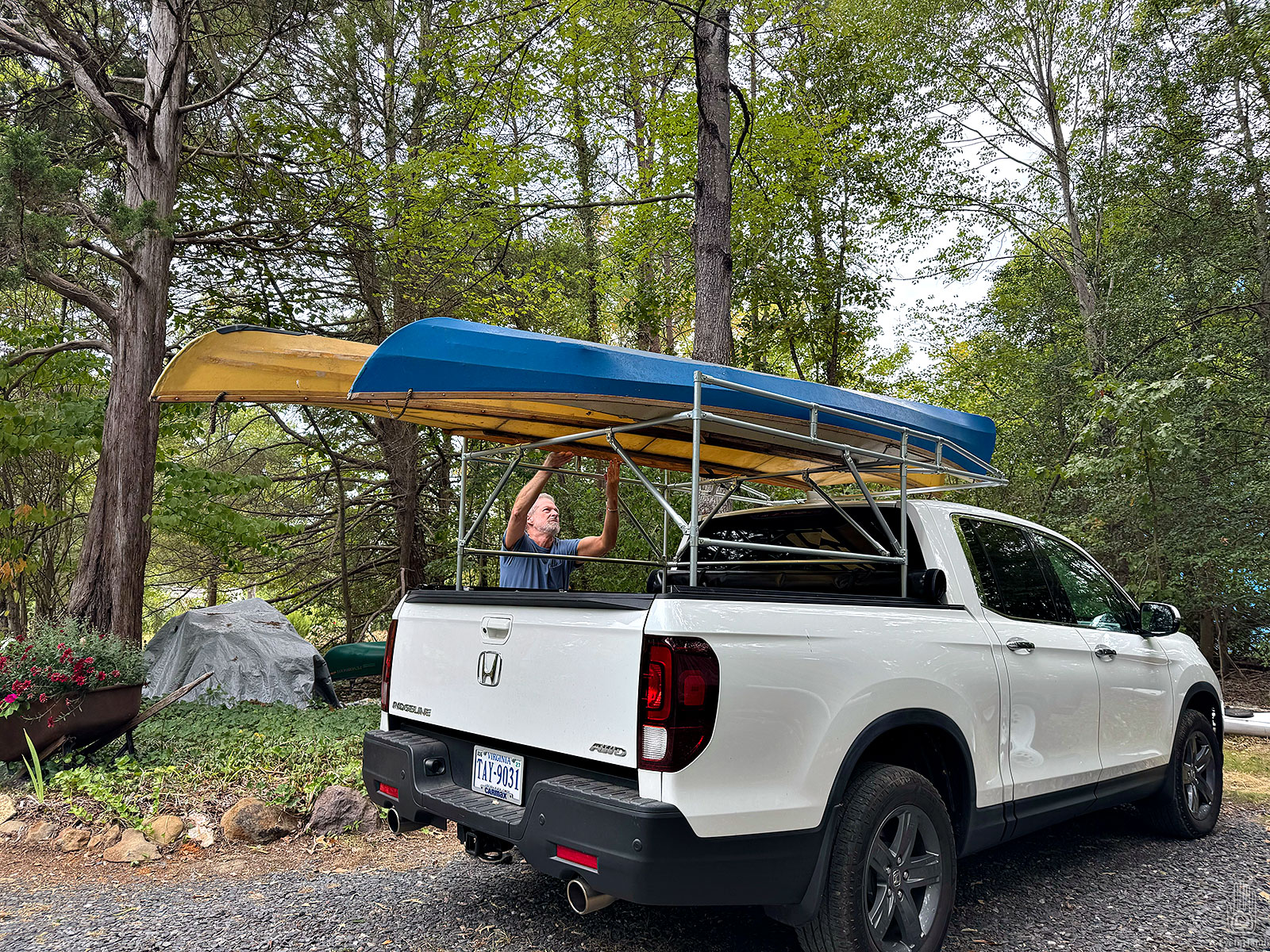
Final test was to throw a kayak on top and go for a paddle. Works great. Only takes about two minutes to lift it in and lock it down. And bonus, it fits nicely in the trailer.
With no further adjustment needed, I dabbed Loctite on all the nuts. Between temperature changes and vibration, don’t want anything jiggling apart at 70mph.
Overall I’m very happy with it. If it lasts 10 years I’ll be even happier.
A nice reprieve from the middle of winter. This is 20+ minutes of sites and sounds from the salt marshes of Mathews County, Virginia. A week on a remote barrier island in the Chesapeake Bay. Over the holidays I had time to go back and review it.
We spent a lot of time kayaking through the shallow winding creeks, often just drifting with the current.
It’s long, so give yourself some time, and good audio – much of this is just the natural sounds of birds and beaches.
The odd noises starting at 12:00 are Clapper Rails. They’re really shy, I’ve never seen one up close, but one stepped out of the grass for a closeup, not realizing we were standing above it on the dock.
Birds seen and/or heard in the video:
Black Scoter
Sandpiper
Clapper Rail
Hooded Merganser
Boat-tailed Grackle
Double-crested Cormorant
Great Blue Heron
At night, there were Great Horned Owls, in the mornings Loons.
A few weeks ago I posted photos from this little trip. I woke up before sunrise and couldn’t go back to sleep, so went for a paddle on Totier Creek.
There was steam rising off the water as the sun came up, a little chilly, but I had the whole place to myself. Just a glorious fall day. Leaves in peak color, glassy calm water, birds singing. So worth it.
Back up the creek I came across some Wood Ducks. They’re shy birds, and this was the first time I’ve seen one up close in the wild here. Even got a little video to prove it.
We saw where the sand ended up; we want to see where it came from – the North end.
The dock is wet and slippery. Tonight is the fullest of Full Moons, the night of an eclipse, so tides are especially high. Water lapped the bottoms of the kayakson top of the pier where I tied them down to pylons.
By early afternoon, we can walk the deck without wading, but the wet parts are slick as greasy ice.
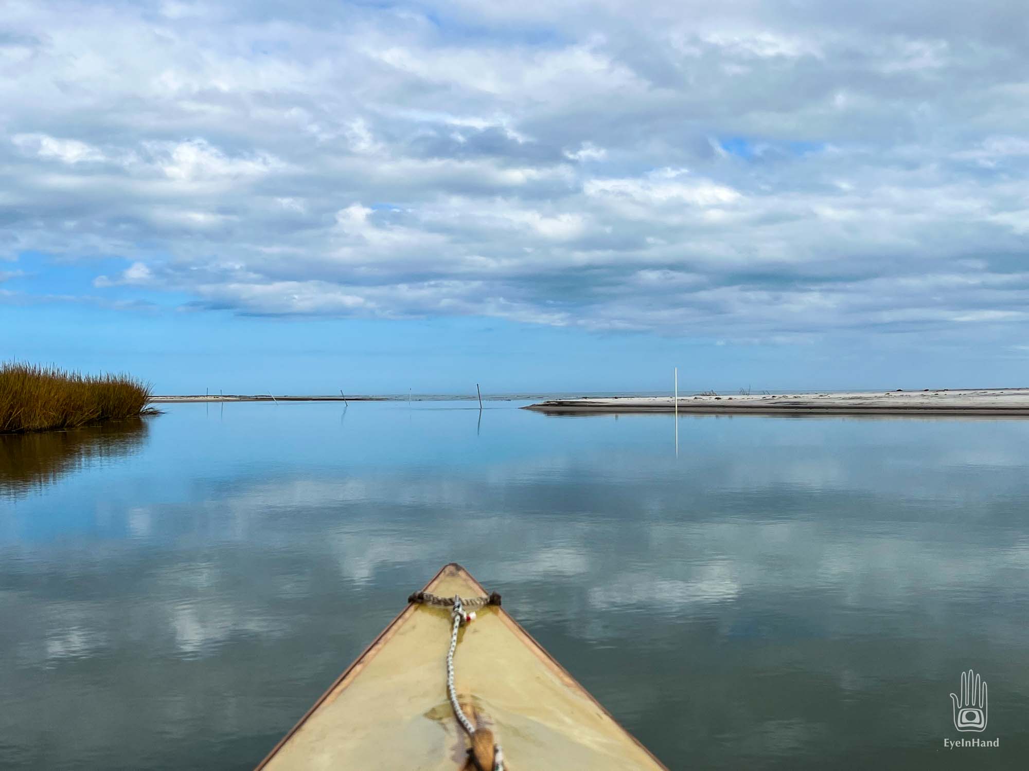
Following oxbow creeks, it’s about two miles to the north inlet. At least it was last year, where inlet was.
It’s an easy paddle on a calm day, riding the outgoing tide. We pass a couple of new duck blinds, the remains of an old one – storm battered, bent down on one knee – another repaired and ready for the coming season.
One by one, the creeks converge on the way to the bay, growing wider and deeper, the current stronger. We round a curve and I have a hard time making sense of what I see. Where before was island and sand and marsh grass, I see an unbroken horizon of blue water.
We paddle beyond the break to what’s left of the sandbar, beach the boats to look around.
Amazing. Last time I paddled to this spot, there was ¾ mile of more creek before reaching the inlet. The island was narrow in places, mostly sand, but very much land. Most of that is gone. This last bend in the creek exits right into the bay.
The former island tip remains apart, a small islet of sand and grass surrounded by water. Clearly won’t be there much longer. The new wider north inlet now extends more than a mile to the mainland. Much of the sand here is washing out in shoals, or sifting into the marsh. Root stubble pokes up through waves of the Bay now, what had been all marsh behind the barrier island, for now still gripping marsh mud.
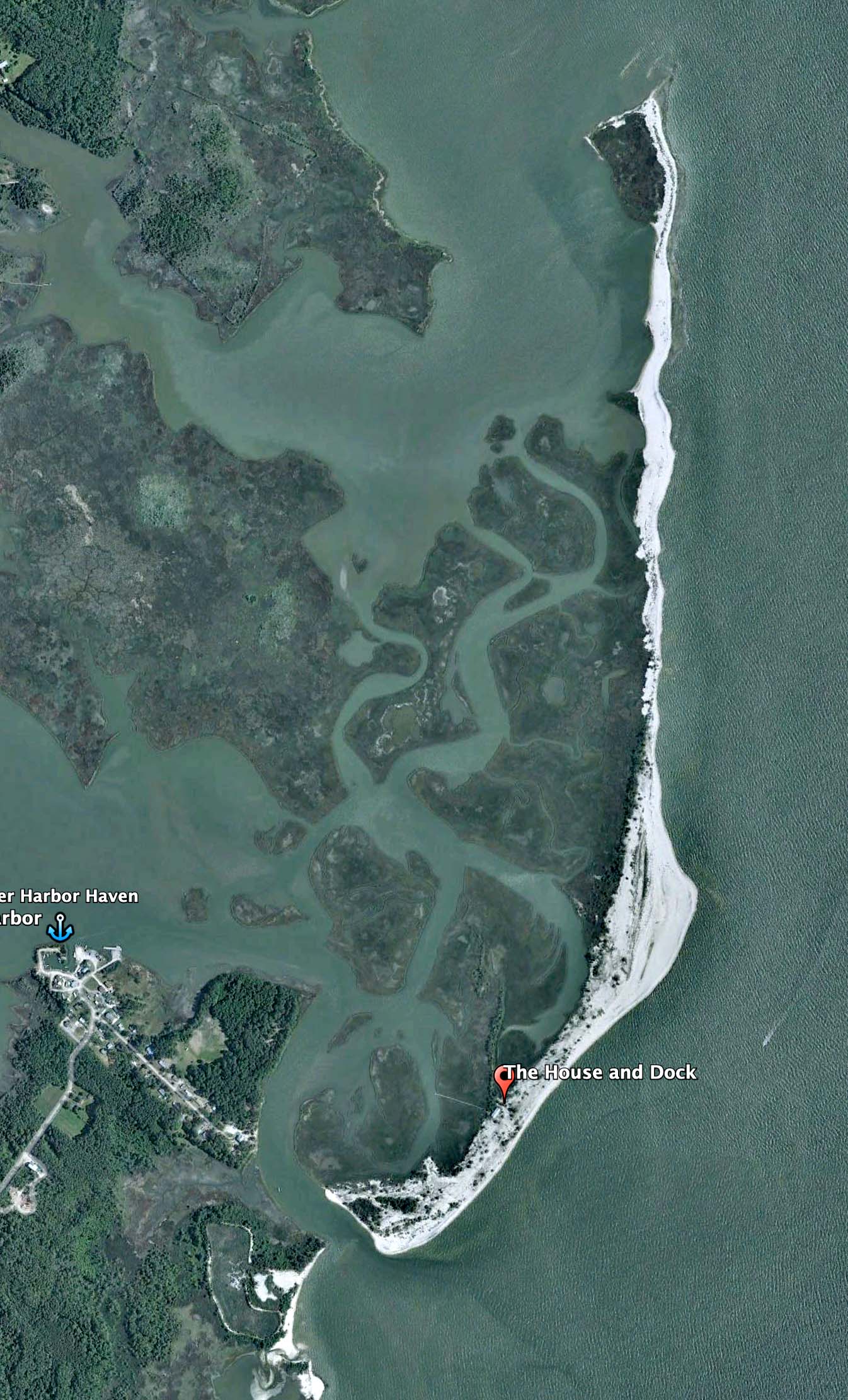
You can see the dramatic change in recent satellite images. Here is the whole island shot ten years ago, with the north and south inlets still deep and navigable by large boats.
2012
And these are the south and north inlets last year, before the winter storms.
South Inlet – 2021North Inlet – 2021. We could walk across that section to the northern tip and keep our feet dry.
And here is the island now, showing both inlets. I’ve edited this to show the current conditions on the satellite image from last year. There’s a new break in the last bend of the creek. The bar just beyond is now water. And the south inlet is a wide sand beach.
You can see the change best if the two images are overlaid and animated. If the animation below is not playing automatically, click on the image to open it.
Animated GIF of ten years of changes. (click to open if not playing)
I knew this was coming, and said so to T. But did not expect it my lifetime; certainly not in the span of a year.
Not sure what we’ll see if we come back next year. A lot less, if the trend continues, and no doubt it will.
Gear and groceries stowed, we headed south to see what weather hath wrought in our absence. It’s a short paddle to follow the old channel around to the inlet, or at least what used to be the inlet.
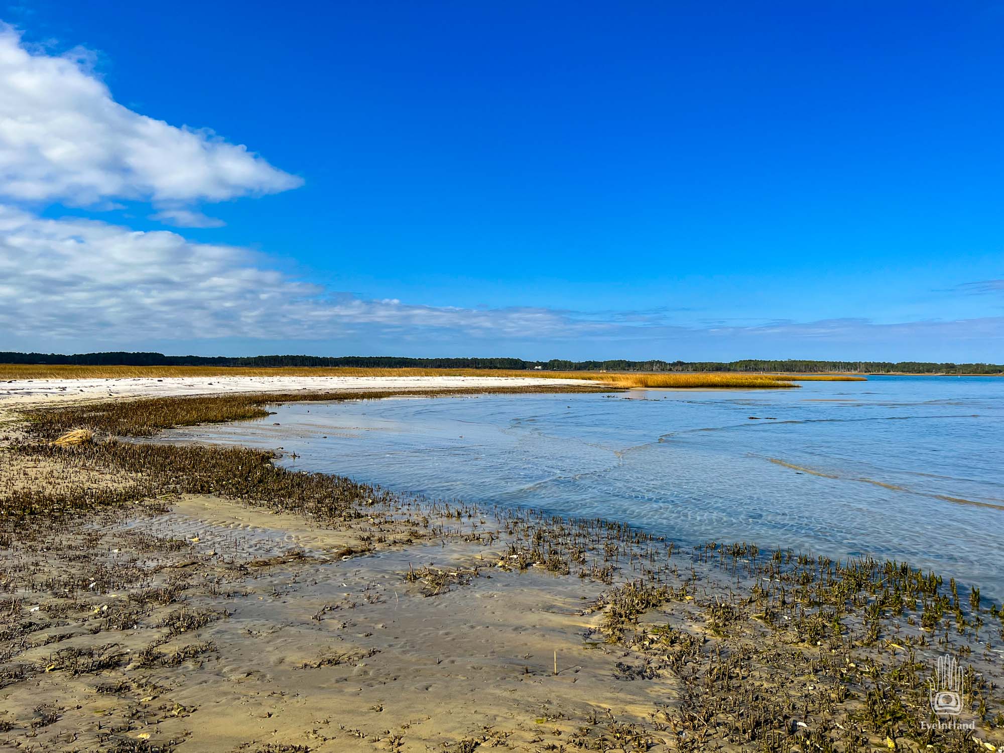
Amazing to think that within my lifetime, steamers could enter through this inlet and anchor in a protected deepwater harbor. Now a broad beach runs from what last year was the southern tip of the island to the mainland, with a dry sandbar three feet high. I knew this was the way it would end up eventually. It’s a process ongoing since the north inlet was formed, cutting the long spit off from the shore and forming the island a century ago. But I did not think it would happen so soon, let alone a single year.
The skin-on-frame kayaks will float in just two inches of water, which came in handy. At low tide, that’s all the water in some places inside the bar and the inlet.
Later, we walked down the beach, and across the bar over what last year had been crashing waves, to the marsh on the mainland at the far end.
Lovely.
Nothing is amiss, all looks as it should.
And yet not at all like it was.
All this sand was water and waves a year ago. On the right is all that remains of the inlet.
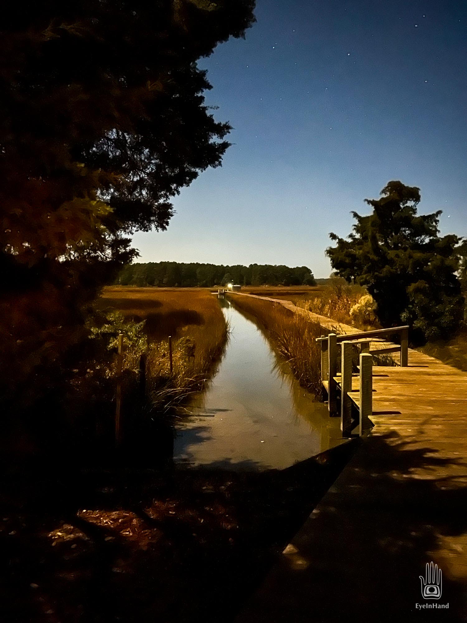
The wind died down with the sunset, replaced by calm, a gibbous moon and sky full of stars.
This is some video shot before Thanksgiving, a week spent on a barrier island in the Chesapeake off the coast of Mathews County.
The trip started with storms and high winds and coastal flooding. A really rough crossing. Within a few days, it blew itself out and left behind sunshine and impossible stillness.
Once you get about 40 seconds into the video, the wind noise dissipates. Then you can hear birds in the marsh, waves, a crackling fire, and Great Horned Owls.
One quiet evening after a beach bonfire, T and I were out staring up at the stars. The peaceful silence was broken by the screams of a rabbit caught in the talons of an owl. The sound was so frightening T grabbed my arm and left a bruise. 🙂
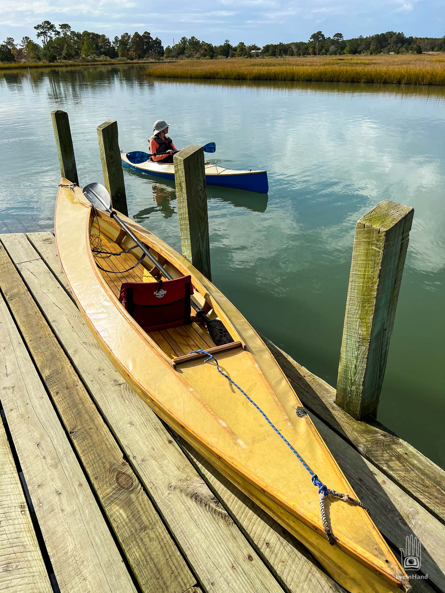
By mid-week we could take the new kayaks out into the tidal creeks. T has the blue Chuckanut 12s, and I have the larger white Chuckanut 15, both designed by good friend Dave Gentry of Gentry Custom Boats. (Plans available through Duckworks.)
A few years ago, I brought one of the Melonseeds here, and had some marvelous sailing. But the inlets have filled in even more since then. At the south end, where steamboats once came into the harbor, you can now wade across the inlet and not get your knees wet. The island is shorter by a hundred yards.
With the creeks silting in, and the weather looking iffy, I was glad to have the new kayaks to bring along. I was often paddling over the mud in less than 3 inches of water.
You can read about the island in previous posts starting here: